
Dosya:Tunisia adm location map.svg

Tam çözünürlük (SVG dosyası, sözde 378 × 743 piksel, dosya boyutu: 162 KB)
Bu dosya Wikimedia Commons'ta bulunmaktadır. Dosyanın açıklaması aşağıda gösterilmiştir. Commons, serbest/özgür telifli medya dosyalarının bulundurulduğu depodur. Siz de yardım edebilirsiniz. |
Özet
| Açıklama |
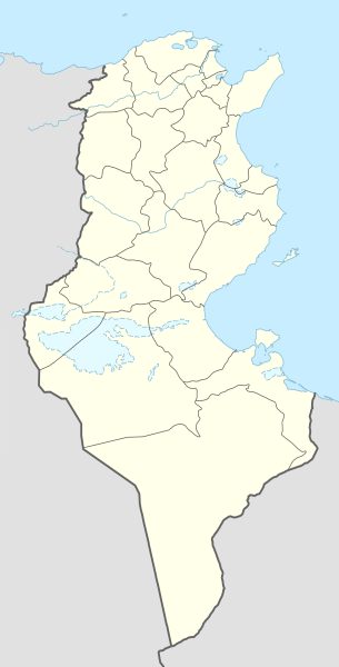
Deutsch: Positionskarte von Tunesien
English: Location map of Tunisia
|
||||||||||||
| Tarih | |||||||||||||
| Kaynak |
Own work using:
|
||||||||||||
| Yazar | NordNordWest | ||||||||||||

|
This map has been made or improved in the German Kartenwerkstatt (Map Lab). You can propose maps to improve as well.
|
Lisanslama
Usage of this file with:

explanatory notes: Legally binding is only the full legalcode. For a free usage I recommend to respect the following licence conditions:
1. Provide my name as given above: NordNordWest,
2. a copy of, or the URI for, the applicable license: https://creativecommons.org/licenses/by-sa/3.0/de/legalcode,
3. the title of the work,
4. in the case of an adaptation, a credit identifying the use of the work in the adaptation.
This license and the rights granted hereunder will terminate automatically upon any breach by you of the terms of this license. Any of the above conditions can be waived if you get permission from the copyright holder. If you have questions or wish differing conditions, please contact me through nnwest or my discussion page ![]() t-online.de
t-online.de
- Şu seçeneklerde özgürsünüz:
- paylaşım – eser paylaşımı, dağıtımı ve iletimi
- içeriği değiştirip uyarlama – eser adaptasyonu
- Aşağıdaki koşullar geçerli olacaktır:
- atıf – Esere yazar veya lisans sahibi tarafından belirtilen (ancak sizi ya da eseri kullanımınızı desteklediklerini ileri sürmeyecek bir) şekilde atıfta bulunmalısınız.
- benzer paylaşım – Maddeyi yeniden karıştırır, dönüştürür veya inşa ederseniz, katkılarınızı orijinal olarak aynı veya uyumlu lisans altında dağıtmanız gerekir.

Dosya geçmişi
Dosyanın herhangi bir zamandaki hâli için ilgili tarih/saat kısmına tıklayın.
| Tarih/Saat | Küçük resim | Boyutlar | Kullanıcı | Yorum | |
|---|---|---|---|---|---|
| güncel | 12.03, 24 Mart 2024 | | 378 × 743 (162 KB) | GrandEscogriffe | more correct north-south stretching |
| 15.59, 9 Kasım 2014 |  | 378 × 713 (146 KB) | NordNordWest | == {{int:filedesc}} == {{Information |Description= {{de|1=Positionskarte von Tunesien}} {{en|1=Location map of Tunisia}} {{Location map series N |stretching=115 |top=37.7 |bottom=30.0 |left=7.2 |right=11.9 }} |Source={{Own using}} * United States Natio... |
Dosya kullanımı
100 sayfadan fazlası bu dosyayı kullanıyor. Aşağıdaki listede sadece bu dosyayı kullanan ilk 100 sayfa gösterilmektedir. Tam listesi mevcuttur.
- 1994 Afrika Uluslar Kupası
- Acim
- Amdun
- Aryana
- Avsca
- Bardo (şehir)
- Beni Haddeş
- Bilheyr
- Bin Kirdan
- Bir Meşerve
- Birü'l-Ahmer
- Bumihelü'l-Basatin
- Carcis
- Cebel Bukarnin
- Cebel Ressas
- Cebelü'l-Vast
- Cemna
- Cumin
- Dakaş
- Duz
- El-Aliye, Tunus
- El-Fahs
- El-Hamma
- El-Kale
- El-Kasr, Tunus
- El-Kerem
- El-Kitar, Tunus
- El-Kâf
- El-Marsa
- El-Muruc
- El-Mâkula
- Et-Tazamun
- Ez-Zehra
- Ez-Zuhur, Kassarin
- Fuşana
- Gamarasin
- Gannuş
- Gezale
- Halkulvâdî
- Hamamü'l-Linf
- Hamamü'ş-Şut
- Hamatü'l-Cerid
- Humetü's-Sevk
- Huzva
- Kaletü'l-Endülüs
- Kartaca (belediye)
- Kisra
- Kubellat
- Mares
- Matar
- Matmatau'l-Cedide
- Matviye
- Mecazü'l-Bab
- Medile
- Mehdiye
- Menzil Abdurrahman
- Menzil Burgiba
- Menzil Cemil
- Menzilü'l-Habib
- Metlin
- Midun
- Mitlevi
- Muneyhile
- Nazur
- Nefta
- Nefza
- Raved
- Ref Raf
- Remada
- Resü'l-Cebel
- Rudeyif
- Safakes
- Sakiyetü'd-Dayir
- Savâf
- Sened
- Sevkü'l-Ahed
- Sevkü'l-Cedid
- Sicnan
- Sidi Ayş
- Sidi Hüseyin
- Sidi Mahluf
- Sidi Sabit
- Simar
- Sukra
- Susa, Tunus
- Tabarsuk
- Tamağza
- Testur
- Teybar
- Tince
- Tunus (şehir)
- Utica, Tunus
- Vadraf
- Zariba
- Zehibe
- Zerat
- Ümmü'l-Arayis
- Şakli Adası
- Şattü'l-Cerid
- Şeniniü'n-Nehal
Bu dosyaya daha fazla bağlantıları gör.
Küresel dosya kullanımı
Aşağıdaki diğer vikiler bu dosyayı kullanır:
- af.wikipedia.org üzerinde kullanımı
- am.wikipedia.org üzerinde kullanımı
- an.wikipedia.org üzerinde kullanımı
- ar.wikipedia.org üzerinde kullanımı
- عروج بربروس
- الرابطة التونسية المحترفة الأولى
- كأس الأمم الإفريقية 2004
- باردو
- قائمة مطارات تونس
- كأس الأمم الإفريقية 1994
- النادي الإفريقي
- قالب:خريطة مدن تونس
- قالب:خارطة جبال تونس
- قالب:خريطة مواقع تونس
- كأس الأمم الإفريقية 1965
- قائمة مدن تونس المتوأمة
- بطولة أمم إفريقيا لكرة السلة 2015
- قالب:خريطة مواقع التراث العالمي في تونس
- قائمة مواقع التراث العالمي في تونس
- قالب:ص.م/موقع جغرافي مضاعف
- قالب:ص.م/موقع جغرافي مضاعف/شرح
- بوابة:التراث العالمي
- بوابة:التراث العالمي/خريطة مختارة
- بوابة:التراث العالمي/قالب وخريطة
- الرابطة التونسية المحترفة الأولى 2015–16
- بطولة إفريقيا لكرة اليد للرجال 2020
- بطولة أمم إفريقيا لكرة السلة 2017
- الرابطة التونسية المحترفة الأولى 2016–17
- الرابطة التونسية المحترفة الأولى 2017–18
- الرابطة التونسية المحترفة الأولى 2018–19
- كلاسيكو تونس
- ديربي تونس الصغير
- الحي الوطني الرياضي
- الرابطة التونسية المحترفة الأولى 2019–20
- وادي الساقي
- وادي سيدي صالح
- الرابطة التونسية المحترفة الأولى 2020–21
- دورة تونس للأمم الأربعة 2003
- وحدة:Location map/data/تونس
- وحدة:Location map/data/تونس/شرح
- كأس إل جي الدولية 1997 (تونس)
- كأس إل جي الدولية 2006 (تونس)
- الرابطة التونسية المحترفة الأولى 2021–22
- بطولة إفريقيا لكرة اليد للرجال 2006
- الرابطة التونسية المحترفة الأولى 2022–23
- جبال تبسة
- الرابطة التونسية المحترفة الأولى 2023–24
- ast.wikipedia.org üzerinde kullanımı
Bu dosyanın daha fazla küresel kullanımını görüntüle.