
Dosya:Syria M5 Highway.svg

Tam çözünürlük (SVG dosyası, sözde 1.040 × 735 piksel, dosya boyutu: 462 KB)
Bu dosya Wikimedia Commons'ta bulunmaktadır. Dosyanın açıklaması aşağıda gösterilmiştir. Commons, serbest/özgür telifli medya dosyalarının bulundurulduğu depodur. Siz de yardım edebilirsiniz. |

Özet
| Açıklama |
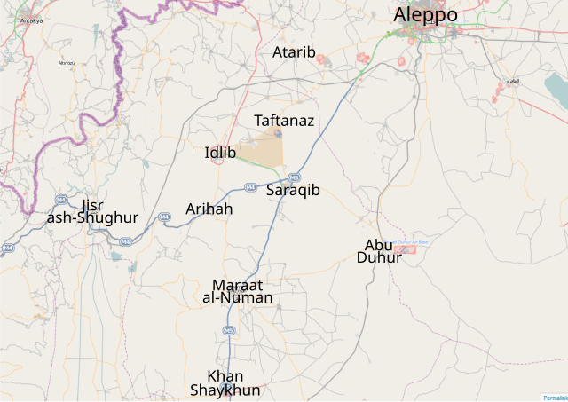
English: Map of the M5 Highway — in the Aleppo Governorate, northern Syria. |
| Tarih | |
| Kaynak | OpenSteetMap |
| Yazar | Futuretrillionaire |
Lisanslama
This work contains information from OpenStreetMap, which is made available under the Open Database License (ODbL). The ODbL does not require any particular license for maps produced from ODbL data. Prior to 1 August 2020, map tiles produced by the OpenStreetMap Foundation were licensed under the CC-BY-SA-2.0 license. Maps produced by other people may be subject to other licences. |

|
Bu belgenin GNU Özgür Belgeleme Lisansı, Sürüm 1.2 veya Özgür Yazılım Vakfı tarafından yayımlanan sonraki herhangi bir sürüm şartları altında bu belgenin kopyalanması, dağıtılması ve/veya değiştirilmesi için izin verilmiştir;
Değişmeyen Bölümler, Ön Kapak Metinleri ve Arka Kapak Metinleri yoktur. Lisansın bir kopyası GNU Özgür Belgeleme Lisansı sayfasında yer almaktadır. |
- Şu seçeneklerde özgürsünüz:
- paylaşım – eser paylaşımı, dağıtımı ve iletimi
- içeriği değiştirip uyarlama – eser adaptasyonu
- Aşağıdaki koşullar geçerli olacaktır:
- atıf – Esere yazar veya lisans sahibi tarafından belirtilen (ancak sizi ya da eseri kullanımınızı desteklediklerini ileri sürmeyecek bir) şekilde atıfta bulunmalısınız.
- benzer paylaşım – Maddeyi yeniden karıştırır, dönüştürür veya inşa ederseniz, katkılarınızı orijinal olarak aynı veya uyumlu lisans altında dağıtmanız gerekir.
Dosya geçmişi
Dosyanın herhangi bir zamandaki hâli için ilgili tarih/saat kısmına tıklayın.
| Tarih/Saat | Küçük resim | Boyutlar | Kullanıcı | Yorum | |
|---|---|---|---|---|---|
| güncel | 15.33, 3 Ocak 2013 | | 1.040 × 735 (462 KB) | FutureTrillionaire | added Taftanaz |
| 17.50, 26 Aralık 2012 |  | 1.040 × 735 (461 KB) | FutureTrillionaire | A more detailed map from OpenStreetMap | |
| 14.09, 23 Ekim 2012 |  | 350 × 440 (170 KB) | FutureTrillionaire | Added 2nd Highway | |
| 13.39, 23 Ekim 2012 |  | 350 × 440 (168 KB) | FutureTrillionaire | Jisr ash-Shugur under govt control | |
| 16.52, 15 Ekim 2012 |  | 350 × 440 (168 KB) | FutureTrillionaire | Azmarin captured [http://www.globalpost.com/dispatch/news/regions/middle-east/syria/121014/syria-rebel-fighters-capture-historical-town-azmarin] | |
| 14.28, 14 Ekim 2012 |  | 350 × 440 (168 KB) | EllsworthSK | Saraqib to blue per http://www.nowlebanon.com/NewsArticleDetails.aspx?ID=446293 | |
| 15.14, 13 Ekim 2012 |  | 350 × 440 (168 KB) | FutureTrillionaire | As requested by Sopher99, Saraqib is changed to blue. | |
| 22.38, 12 Ekim 2012 |  | 350 × 440 (168 KB) | FutureTrillionaire | Added Azmarin | |
| 21.56, 12 Ekim 2012 |  | 350 × 440 (167 KB) | FutureTrillionaire | Smaller text | |
| 21.50, 12 Ekim 2012 |  | 350 × 440 (166 KB) | FutureTrillionaire | Bigger |
Dosya kullanımı
Bu görüntü dosyasına bağlantısı olan sayfalar:
Küresel dosya kullanımı
Aşağıdaki diğer vikiler bu dosyayı kullanır:
- ar.wikipedia.org üzerinde kullanımı
- en.wikipedia.org üzerinde kullanımı
- es.wikipedia.org üzerinde kullanımı
- nl.wikipedia.org üzerinde kullanımı
- pl.wikipedia.org üzerinde kullanımı
- www.wikidata.org üzerinde kullanımı
- zh.wikipedia.org üzerinde kullanımı