
Dosya:Sand and gravel extraction site - geograph.org.uk - 923943.jpg
Daha yüksek çözünürlüğe sahip sürüm bulunmamaktadır.
Sand_and_gravel_extraction_site_-_geograph.org.uk_-_923943.jpg ((640 × 480 piksel, dosya boyutu: 174 KB, MIME tipi: image/jpeg))
Bu dosya Wikimedia Commons'ta bulunmaktadır. Dosyanın açıklaması aşağıda gösterilmiştir. Commons, serbest/özgür telifli medya dosyalarının bulundurulduğu depodur. Siz de yardım edebilirsiniz. |
Özet
| Açıklama |
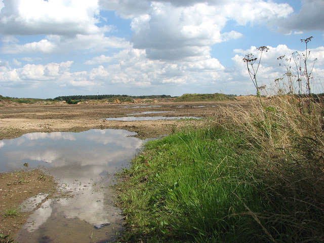
English: Sand and gravel extraction site. By Salters Lane. This gravel extraction site extends all the way along Salters Lane > 923914 until it meets Reed Lane > 923955 further to the east. Signs put up by the entrances warn that this site is not a play area > 923934. This area forms part of what used to be the parish of Launditch.
Launditch (the original spelling is Launditcth) is described in White's History, Gazetteer and Directory of Norfolk (1845) as being "of an irregular, quadrangular figure, averaging about 12 miles in length and breadth, and bounded on the north by Gallow, on the east by Eynesford, on the south by Mitford and South Greenhoe, and on the west by Freebridge-Lynn Hundred. It is a highly cultivated district, rising in some places in bold and picturesque swells, with many thriving plantations and handsome mansions, and watered by the Wensum, the Nar, and several smaller streams, which rise within its limits. It takes its name from a long ditch and bank extending from Wendling-car to the low lands near Mileham, and supposed to have been made for the purpose of carrying off the drain water. At the point where this ditch crosses the Norwich road, the Hundred court was anciently held. Launditch, (with the exception of Colkirk and Hoe) forms the Deanery of Brisley, in the Archdeaconry of Norwich." |
| Tarih | |
| Kaynak | From geograph.org.uk |
| Yazar | Evelyn Simak |
| Atıf (required by the license) | Evelyn Simak / Sand and gravel extraction site / |
| Kamera pozisyonu | | Bu ve diğer görüntülerin konumlarını şurada belirle: OpenStreetMap |
|---|
_heading:90.00&language=tr)
| Nesne pozisyonu | | Bu ve diğer görüntülerin konumlarını şurada belirle: OpenStreetMap |
|---|
_heading:90.00&language=tr)
Lisanslama

|
Bu Coğrafya projesinden alınmış olan bir görüntüdür. Coğrafi internet sitesinde bulunan bu fotoğraf sayfasından fotoğrafçıya ait iletişim bilgilerine ulaşabilirsiniz. Bu görüntünün telif hakkı sahibi Evelyn Simak olup, yeniden kullanılması amacıyla Creative Commons Attribution-ShareAlike 2.0 lisansı ile lisanslandırılmıştır.
|
Bu dosya, Creative Commons Atıf-Benzer Paylaşım 2.0 Genel lisansı ile lisanslanmıştır
Atıf: Evelyn Simak
- Şu seçeneklerde özgürsünüz:
- paylaşım – eser paylaşımı, dağıtımı ve iletimi
- içeriği değiştirip uyarlama – eser adaptasyonu
- Aşağıdaki koşullar geçerli olacaktır:
- atıf – Esere yazar veya lisans sahibi tarafından belirtilen (ancak sizi ya da eseri kullanımınızı desteklediklerini ileri sürmeyecek bir) şekilde atıfta bulunmalısınız.
- benzer paylaşım – Maddeyi yeniden karıştırır, dönüştürür veya inşa ederseniz, katkılarınızı orijinal olarak aynı veya uyumlu lisans altında dağıtmanız gerekir.
Dosya geçmişi
Dosyanın herhangi bir zamandaki hâli için ilgili tarih/saat kısmına tıklayın.
| Tarih/Saat | Küçük resim | Boyutlar | Kullanıcı | Yorum | |
|---|---|---|---|---|---|
| güncel | 03.57, 22 Şubat 2011 | | 640 × 480 (174 KB) | GeographBot | == {{int:filedesc}} == {{Information |description={{en|1=Sand and gravel extraction site By Salters Lane. This gravel extraction site extends all the way along Salters Lane > http://www.geograph.org.uk/photo/923914 until it meets Reed Lane > http://www.ge |
Dosya kullanımı
Bu görüntü dosyasına bağlantısı olan sayfalar:
Küresel dosya kullanımı
Aşağıdaki diğer vikiler bu dosyayı kullanır:
- ceb.wikipedia.org üzerinde kullanımı
- cy.wikipedia.org üzerinde kullanımı
- en.wikipedia.org üzerinde kullanımı
- pl.wikipedia.org üzerinde kullanımı
- www.wikidata.org üzerinde kullanımı