
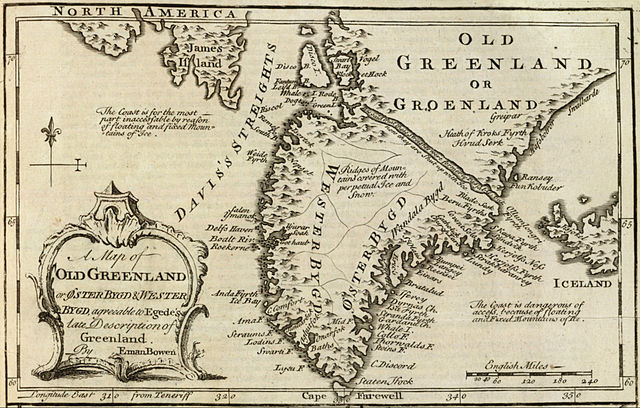
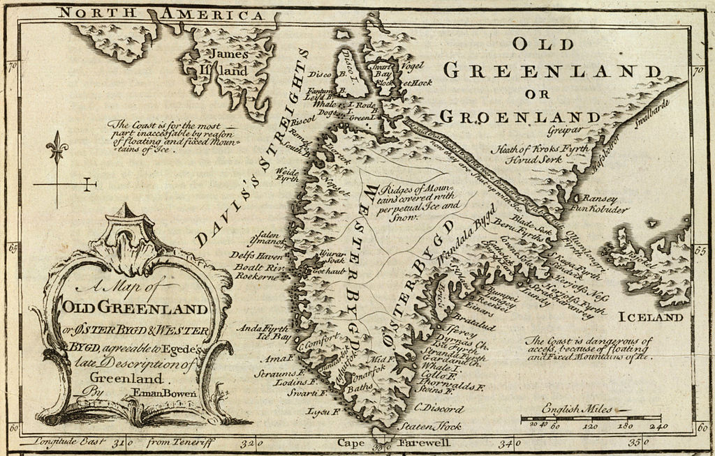
Dosya:Old Greenland 1747.jpg

Tam çözünürlük ((2.048 × 1.307 piksel, dosya boyutu: 2,23 MB, MIME tipi: image/jpeg))
Bu dosya Wikimedia Commons'ta bulunmaktadır. Dosyanın açıklaması aşağıda gösterilmiştir. Commons, serbest/özgür telifli medya dosyalarının bulundurulduğu depodur. Siz de yardım edebilirsiniz. |
Özet
| Açıklama |
English: Cropped and rotated from the original.
|
| Tarih | |
| Kaynak | David Rumsey Collection |
| Yazar | Emanuel Bowen (c. 1694–1767) |
Lisanslama
|
Bu görüntüde gösterilmekte olan iki boyutlu sanat yapıtı,
Dolayısıyla, o sanat yapıtına ait bu tekrar üretim görüntüsü de kamu malıdır.
Tanımlanan durum, ABD (bakınız, Bridgeman Art Library v. Corel Corp. - Bridgeman Sanat Kütüphanesi Corel Şirketine karşı), Almanya ve diğer pek çok ülkede yaratılmış tekrar üretimler için geçerlidir.
| ||||
Dosya geçmişi
Dosyanın herhangi bir zamandaki hâli için ilgili tarih/saat kısmına tıklayın.
| Tarih/Saat | Küçük resim | Boyutlar | Kullanıcı | Yorum | |
|---|---|---|---|---|---|
| güncel | 15.21, 10 Mayıs 2012 | | 2.048 × 1.307 (2,23 MB) | LlywelynII |
Dosya kullanımı
Bu görüntü dosyasına bağlantısı olan sayfalar:
Küresel dosya kullanımı
Aşağıdaki diğer vikiler bu dosyayı kullanır:
- af.wikipedia.org üzerinde kullanımı
- ar.wikipedia.org üzerinde kullanımı
- bs.wikipedia.org üzerinde kullanımı
- ca.wikipedia.org üzerinde kullanımı
- ceb.wikipedia.org üzerinde kullanımı
- cs.wikipedia.org üzerinde kullanımı
- en.wikipedia.org üzerinde kullanımı
- es.wikipedia.org üzerinde kullanımı
- fa.wikipedia.org üzerinde kullanımı
- fy.wikipedia.org üzerinde kullanımı
- io.wikipedia.org üzerinde kullanımı
- ko.wikipedia.org üzerinde kullanımı
- pt.wikipedia.org üzerinde kullanımı
- sv.wikipedia.org üzerinde kullanımı
- te.wikipedia.org üzerinde kullanımı
- uk.wikipedia.org üzerinde kullanımı
- www.wikidata.org üzerinde kullanımı
- zh.wikipedia.org üzerinde kullanımı