
Dosya:LocationMap-MarsCuriosityRover-Sol1705-20170522.jpg

Tam çözünürlük ((4.800 × 3.600 piksel, dosya boyutu: 3,05 MB, MIME tipi: image/jpeg))
Bu dosya Wikimedia Commons'ta bulunmaktadır. Dosyanın açıklaması aşağıda gösterilmiştir. Commons, serbest/özgür telifli medya dosyalarının bulundurulduğu depodur. Siz de yardım edebilirsiniz. |
Özet
| Açıklama |
English: 05.22.2017
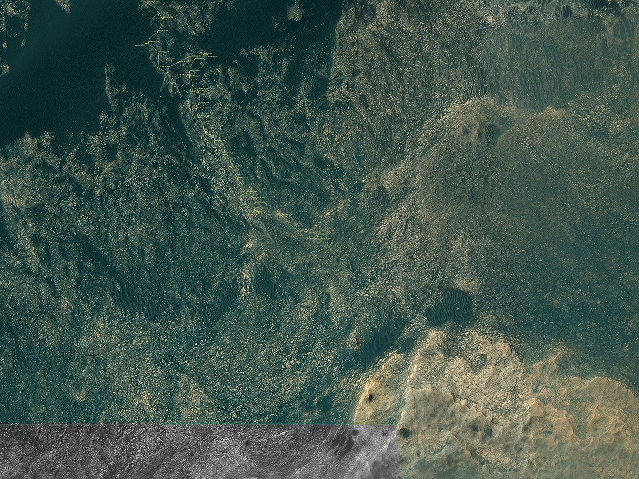
Curiosity Rover's Location for Sol 1705 https://mars.jpl.nasa.gov/multimedia/images/2017/curiosity-rovers-location-for-sol-1705 This map shows the route driven by NASA's Mars rover Curiosity through the 1705 Martian day, or sol, of the rover's mission on Mars (May 22, 2017). Numbering of the dots along the line indicate the sol number of each drive. North is up. From Sol 1703 to Sol 1705, Curiosity had driven a straight line distance of about 23.43 feet (7.14 meters). Since touching down in Bradbury Landing in August 2012, Curiosity has driven 10.25 miles (16.50 kilometers). The base image from the map is from the High Resolution Imaging Science Experiment Camera (HiRISE) in NASA's Mars Reconnaissance Orbiter. |
| Tarih | |
| Kaynak | https://mars.jpl.nasa.gov/imgs/2017/05/Curiosity_Location_Sol1705-full.jpg |
| Yazar | https://mars.jpl.nasa.gov/imgs/2017/05/Curiosity_Location_Sol1705-full.jpg |
Lisanslama
| Bu dosya NASA tarafından üretildiği için kamu malıdır. Aksi belirtilmediği sürece "NASA tarafından üretilen malzemenin telif hakkı olmadığı" NASA telif politikasında belirtilmiştir. (Bkz. Template:PD-USGov, NASA copyright policy page veya JPL Image Use Policy.) | ||
 |
Uyarılar:
|
Dosya geçmişi
Dosyanın herhangi bir zamandaki hâli için ilgili tarih/saat kısmına tıklayın.
| Tarih/Saat | Küçük resim | Boyutlar | Kullanıcı | Yorum | |
|---|---|---|---|---|---|
| güncel | 01.17, 27 Mayıs 2017 | | 4.800 × 3.600 (3,05 MB) | Drbogdan | User created page with UploadWizard |
Dosya kullanımı
Bu görüntü dosyasına bağlantısı olan sayfalar:
Küresel dosya kullanımı
Aşağıdaki diğer vikiler bu dosyayı kullanır:
- fi.wikipedia.org üzerinde kullanımı