Dosya:ISS-30 East African Rift Valley in Kenya.jpg

Sayfa içeriği diğer dillerde desteklenmemektedir.
Vikipedi, özgür ansiklopedi

Tam çözünürlük((4.288 × 2.848 piksel, dosya boyutu: 1,29 MB, MIME tipi: image/jpeg))


Özet

Açıklama
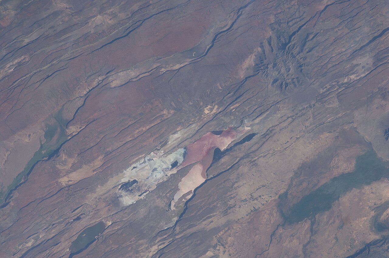
English: The East African Rift Valley in Kenya is featured in this image photographed by an Expedition 30 crew member on the International Space Station.
  • This photograph highlights classical geological structures associated with a tectonic rift valley, in this case the Eastern Branch of the East African Rift near Kenya's southern border with Tanzania and just south of the Equator. The East African Rift is one of the great tectonic features of Africa, caused by fracturing of Earth's crust. The Nubian (or African) plate includes the older continental crust of Africa to the west, while the Somali plate that is moving away includes the Horn of Africa to the northeast; the tectonic boundary stretches from the southern Red Sea to central Mozambique. Landscapes in the rift valley can appear confusing.
  • The most striking features in this view are the numerous, nearly parallel, linear fault lines that occupy the floor of the valley (most of the image). Shadows cast by the late afternoon sun make the fault scarps (steps in the landscape caused by slip motion along individual faults) more prominent. The faults are aligned with the north-south axis of the valley (lower left to top right). A secondary trend of less linear faults cuts the main fault trend at an acute angle, the fault steps throwing large shadows. The Eastern Branch of the East African Rift is arid (compared with the Western Branch which lies on the border of the Congolese rainforest). Evidence of this can be seen in the red, salt-loving algae of the shallow and salty Lake Magadi (center).
  • A neighboring small lake to the north has deeper water and appears dark in the image. The white salt deposits of the dry part of the Lake Magadi floor (center) host a few small commercial salt pans. The lakes appear to be located where the main and secondary fault trends intersect. The East African rift system is marked by substantial volcanic activity, including lavas erupted from fissures along the rift in the region. Much of the faulting observed in this image cuts through such lavas. Elsewhere along the rift system individual volcanoes form. Some of those volcanoes are very large, including Mt. Kilimanjaro and Mt. Kenya. In this image, rising 400 meters above the valley floor, a volcano appears to be superimposed on the faults—indicating that the volcano is younger than the faults it covers.
  • Deeply eroded slopes also suggest that the volcano has not been active for a long time. The largest vegetated area (lower left)—in an desert zone with no vegetation visible to the naked eye from space—is the green floor of a valley which drains an area large enough for water to exist near the surface so that plants can thrive. For a sense of scale, the vegetated valley floor is 17 kilometers long (10.5 miles).
Tarih
Kaynak http://spaceflight.nasa.gov/gallery/images/station/crew-30/html/iss030e035487.html
Yazar NASA
Diğer sürümler
Bu görüntü veya video ABD Ulusal Havacılık ve Uzay Dairesi (NASA) Johnson Space Centertarafından Fotoğraf ID: ISS030-E-035487 ile kataloğa alınmıştır.

Bu etiket, ekli çalışmanın telif hakkı durumunu göstermez. Normal bir telif hakkı etiketi hâlâ gereklidir. Commons:Lisanslama sayfasına bakın.
Diğer diller:

Lisanslama

Public domain
This file is in the public domain in the United States because it was created by the Image Science & Analysis Laboratory, of the NASA Johnson Space Center. NASA copyright policy states that "NASA material is not protected by copyright unless noted". (NASA media use guidelines or Conditions of Use of Astronaut Photographs). Photo source: ISS030-E-35487.

العربيَّة | Deutsch | English | español | français | italiano | kurdî | македонски | മലയാളം | português | sicilianu | +/−

Altyazılar

Bu dosyanın temsil ettiği şeyin tek satırlık açıklamasını ekleyin.

Bu dosyada gösterilen öğeler

betimlenen

14 Ocak 2012

Dosya geçmişi

Dosyanın herhangi bir zamandaki hâli için ilgili tarih/saat kısmına tıklayın.

Tarih/SaatKüçük resimBoyutlarKullanıcıYorum
güncel20.24, 3 Nisan 201220.24, 3 Nisan 2012 tarihindeki sürümün küçültülmüş hâli4.288 × 2.848 (1,29 MB)Ras67{{Information |Description={{en|1=The East African Rift Valley in Kenya is featured in this image photographed by an Expedition 30 crew member on the International Space Station. * This photograph highlights classical geological structures associated w...

Bu görüntü dosyasına bağlantısı olan sayfalar:

Meta veri