
Dosya:Brong Ahafo districts.png

Bu önizlemenin boyutu: 776 × 600 piksel. Diğer çözünürlükler: 311 × 240 piksel | 621 × 480 piksel | 994 × 768 piksel | 1.056 × 816 piksel.
Tam çözünürlük ((1.056 × 816 piksel, dosya boyutu: 49 KB, MIME tipi: image/png))
Bu dosya Wikimedia Commons'ta bulunmaktadır. Dosyanın açıklaması aşağıda gösterilmiştir. Commons, serbest/özgür telifli medya dosyalarının bulundurulduğu depodur. Siz de yardım edebilirsiniz. |
Özet
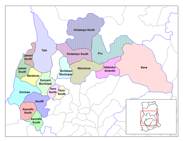
| Açıklama | Map of the districts of the Brong Ahafo region of Ghana. Created by Rarelibra for public domain use. Created using MapInfo Professional v7.5 and various mapping resources. |
| Tarih | 28 Haziran 2006 (original upload date) |
| Kaynak | No machine-readable source provided. Own work assumed (based on copyright claims). |
| Yazar | No machine-readable author provided. Ahanta assumed (based on copyright claims). |
Lisanslama
| Ben, bu işin telif sahibi, bu işi kamu malı olarak yayınlıyorum. Bu dünya çapında geçerlidir. Bazı ülkelerde bu yasal olarak mümkün olmayabilir; öyleyse: Ben, bu işi herhangi bir amaç için, herhangi bir şart olmaksızın, yasalarca gerekli olmadıkça, herkesin kullanmasına izin veriyorum. |
Dosya geçmişi
Dosyanın herhangi bir zamandaki hâli için ilgili tarih/saat kısmına tıklayın.
| Tarih/Saat | Küçük resim | Boyutlar | Kullanıcı | Yorum | |
|---|---|---|---|---|---|
| güncel | 10.27, 28 Haziran 2006 | | 1.056 × 816 (49 KB) | Ahanta | Map of the districts of the Brong Ahafo region of Ghana. Created by Rarelibra for public domain use. Created using MapInfo Professional v7.5 and various mapping resources. [edit] I, the creator of this work, hereby release it into the public domain. This |
Dosya kullanımı
Bu görüntü dosyasına bağlantısı olan sayfalar:
Küresel dosya kullanımı
Aşağıdaki diğer vikiler bu dosyayı kullanır:
- ca.wikipedia.org üzerinde kullanımı
- ceb.wikipedia.org üzerinde kullanımı
- dag.wikipedia.org üzerinde kullanımı
- da.wikipedia.org üzerinde kullanımı
- de.wikipedia.org üzerinde kullanımı
- dga.wikipedia.org üzerinde kullanımı
- en.wikipedia.org üzerinde kullanımı
- Dormaa District
- Asutifi District
- Nkoranza District
- Sene District
- Atebubu District
- Pru District
- Jaman District
- Berekum-Jaman District
- Kintampo District
- Asunafo District
- User talk:Rarelibra/Maps2
- List of hospitals in Ghana
- List of Ghana Parliament constituencies
- Nsoatre
- User:GerardM/Districts of Ghana
- Tano District, Ghana
- es.wikipedia.org üzerinde kullanımı
- fa.wikipedia.org üzerinde kullanımı
- frr.wikipedia.org üzerinde kullanımı
- fr.wikipedia.org üzerinde kullanımı
Bu dosyanın daha fazla küresel kullanımını görüntüle.