
Dosya:This amphitheatre @ Myra Turkie is situated next to the Lycian rock tombs. It is interesting to see as it is quite well preserved and the largest in Lycia. It is associated with ancient history.jpg

Tam çözünürlük ((8.256 × 5.504 piksel, dosya boyutu: 34,05 MB, MIME tipi: image/jpeg))
Bu dosya Wikimedia Commons'ta bulunmaktadır. Dosyanın açıklaması aşağıda gösterilmiştir. Commons, serbest/özgür telifli medya dosyalarının bulundurulduğu depodur. Siz de yardım edebilirsiniz. |
Özet
| Açıklama |
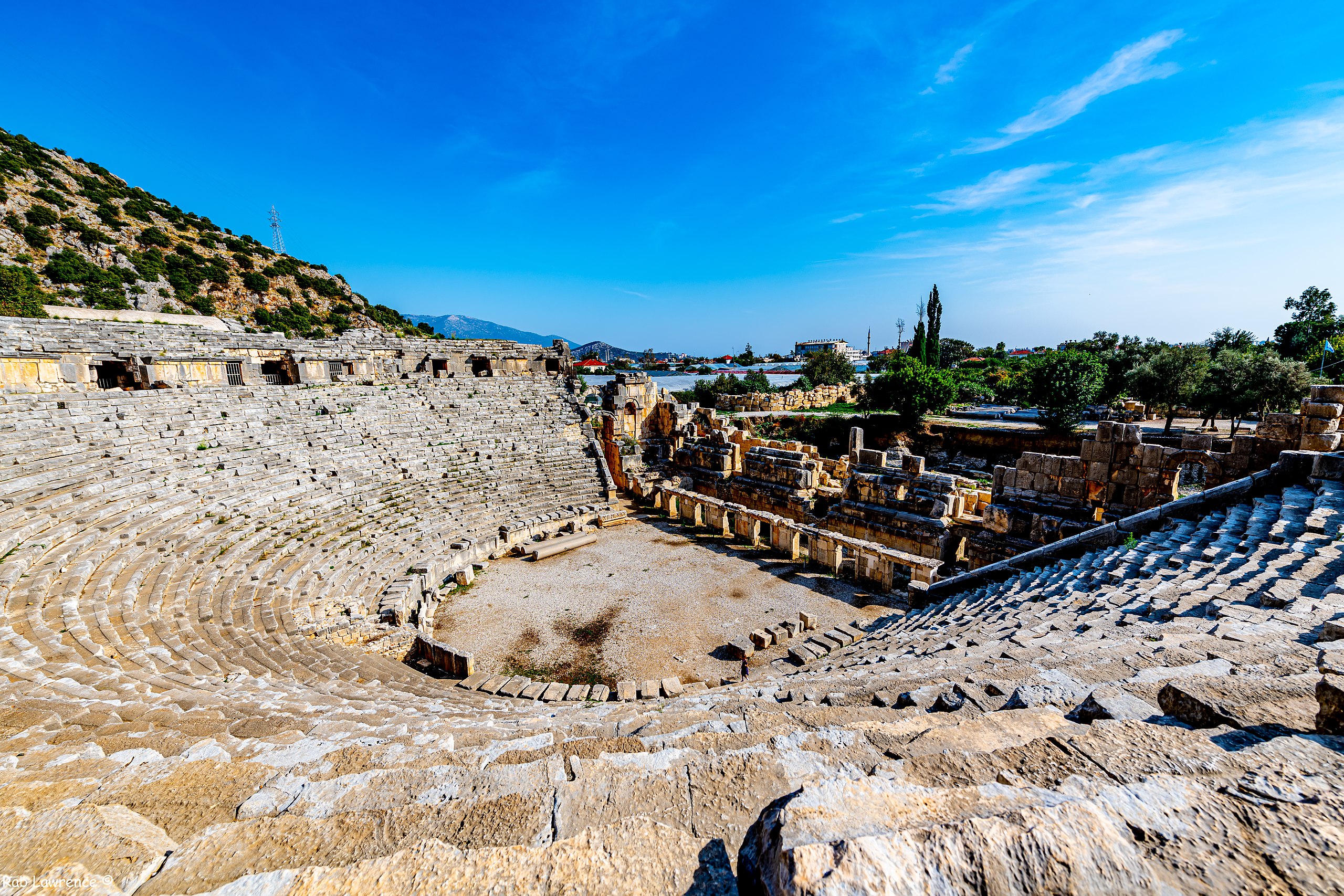
English: Though archaeologists rank the exquisite necropolises at Myra as classics of Lycian culture, the site’s most beautiful elements are some of its touching, humanizing details.
Dating back to the 4th century BCE, the rock-cut tombs line the hills above Myra’s famed theater and the Church of St. Nicholas. These houses of the dead are divided into two main necropolises comprised of a mixture of house- and temple-style tombs: the ocean necropolis and the river necropolis. Colorful as they seem now, most have faded greatly over the years after having been painted brilliant shades of red, yellow, blue, and purple in their prime. The most famous example of this was documented by early explorer Charles Fellows during his visit in 1840. Named after the lion and bull adorning its facade, the “Lion Tomb” also contains 11 life-sized stone figures thought to represent the grave owner’s family. A number of inscriptions in ancient Greek and Lycian appear carved throughout, including one that sounds as if it could’ve been written just yesterday: "Moschos loves Philiste, the daughter of Demetrios". Once exclusively the provenance of the upper and middle classes, the presence of Myra’s remarkable necropolises signal the residents’ former prosperity in addition to an ongoing sense of security that translated from this world into the next. |
| Tarih | |
| Kaynak | https://www.flickr.com/photos/p300njb/49147410896/ |
| Yazar | Rab Lawrence |
| Kamera pozisyonu | | Bu ve diğer görüntülerin konumlarını şurada belirle: OpenStreetMap |
|---|
Lisanslama
- Şu seçeneklerde özgürsünüz:
- paylaşım – eser paylaşımı, dağıtımı ve iletimi
- içeriği değiştirip uyarlama – eser adaptasyonu
- Aşağıdaki koşullar geçerli olacaktır:
- atıf – Esere yazar veya lisans sahibi tarafından belirtilen (ancak sizi ya da eseri kullanımınızı desteklediklerini ileri sürmeyecek bir) şekilde atıfta bulunmalısınız.
| This image was originally posted to Flickr by Rab . at https://flickr.com/photos/58739232@N07/49147410896. It was reviewed on 10 Nisan 2022 by FlickreviewR 2 and was confirmed to be licensed under the terms of the cc-by-2.0. |
Dosya geçmişi
Dosyanın herhangi bir zamandaki hâli için ilgili tarih/saat kısmına tıklayın.
| Tarih/Saat | Küçük resim | Boyutlar | Kullanıcı | Yorum | |
|---|---|---|---|---|---|
| güncel | 22.30, 10 Nisan 2022 | | 8.256 × 5.504 (34,05 MB) | Magnum5051 | Uploaded a work by Rab Lawrence from https://www.flickr.com/photos/p300njb/49147410896/ with UploadWizard |
Dosya kullanımı
Bu görüntü dosyasına bağlantısı olan sayfalar:
Küresel dosya kullanımı
Aşağıdaki diğer vikiler bu dosyayı kullanır:
- en.wikipedia.org üzerinde kullanımı
- pl.wiktionary.org üzerinde kullanımı