
Dosya:West Yorkshire outline map with UK.png
Daha yüksek çözünürlüğe sahip sürüm bulunmamaktadır.
West_Yorkshire_outline_map_with_UK.png ((800 × 558 piksel, dosya boyutu: 407 KB, MIME tipi: image/png))
Bu dosya Wikimedia Commons'ta bulunmaktadır. Dosyanın açıklaması aşağıda gösterilmiştir. Commons, serbest/özgür telifli medya dosyalarının bulundurulduğu depodur. Siz de yardım edebilirsiniz. |
Özet
| Açıklama |
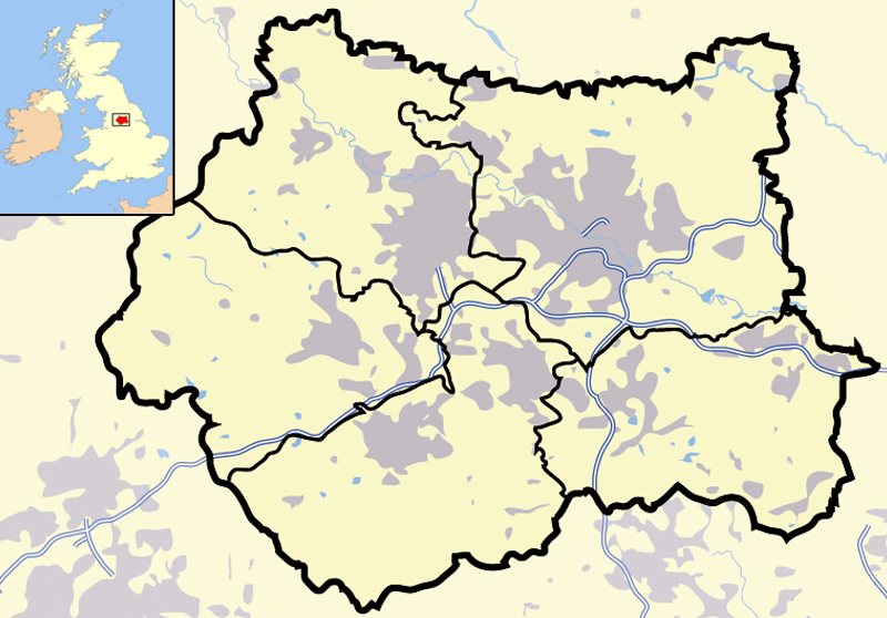
Map of en:West Yorkshire and surrounding area, with indented map of the British Isles for national context. County and borough boundaries in black, urban areas in grey, motorways in blue with white stripe, water bodies in light blue. |
| Tarih | 9 Nisan 2007 (original upload date) |
| Kaynak | en.wikipedia üzerinden Commons'a transfer edildi. |
| Yazar | Jhamez84 at İngilizce Vikipedi |
Lisanslama
| Bu iş yazarı Jhamez84 at İngilizce Vikipedi tarafından kamu malı olarak yayınlanmıştır. Bu dünya çapında geçerlidir. Bazı ülkelerde bu yasal olarak mümkün olmayabilir; öyleyse: Jhamez84, bu işi herhangi bir amaç için, herhangi bir şart olmaksızın, yasalarca gerekli olmadıkça, herkesin kullanmasına izin veriyor. |
Orijinal yükleme günlüğü
Dosyanın orjinal açıklama sayfası burada bulunmaktadır. Aşağıdaki tüm kullanıcı adları için en.wikipedia bakın.
- 2007-04-09 23:11 Jhamez84 800×558×8 (416924 bytes) Map of [[West Yorkshire]] and surrounding area, with indented map of the British Isles for national context. County and borough boundaries in black, urban areas in grey, motorways in blue with white stripe, water bodies in light blue.
Dosya geçmişi
Dosyanın herhangi bir zamandaki hâli için ilgili tarih/saat kısmına tıklayın.
| Tarih/Saat | Küçük resim | Boyutlar | Kullanıcı | Yorum | |
|---|---|---|---|---|---|
| güncel | 21.02, 29 Haziran 2007 | | 800 × 558 (407 KB) | Pit-yacker | {{Information |Description=Map of en:West Yorkshire and surrounding area, with indented map of the British Isles for national context. County and borough boundaries in black, urban areas in grey, motorways in blue with white stripe, water bodies in |
Dosya kullanımı
Bu görüntü dosyasına bağlanan sayfa yok.
Küresel dosya kullanımı
Aşağıdaki diğer vikiler bu dosyayı kullanır:
- cs.wikipedia.org üzerinde kullanımı
- en.wikipedia.org üzerinde kullanımı
- en.wikinews.org üzerinde kullanımı
- es.wikipedia.org üzerinde kullanımı
- id.wikipedia.org üzerinde kullanımı
- Chapel Allerton
- Farnley
- Headingley
- Roundhay
- Seacroft
- Shadwell
- Pudsey
- Otley
- Garforth
- Templat:Location map West Yorkshire
- Rothwell
- Wetherby
- Holbeck
- Hunslet
- Armley
- Wortley
- Burley, Leeds
- Cross Gates
- Middleton
- Gipton
- Belle Isle
- Halton Moor
- Moortown
- Alwoodley
- Colton, Leeds
- Oakwood, Leeds
- Adel, Leeds
- Bramley, Leeds
- Katedral Leeds
- it.wikipedia.org üzerinde kullanımı
- ml.wikipedia.org üzerinde kullanımı
- qu.wikipedia.org üzerinde kullanımı
- ug.wikipedia.org üzerinde kullanımı