
Dosya:Location of Isauria-Asia Minor Map, Classical Atlas, 1886, Keith Johnston.jpg
Location_of_Isauria-Asia_Minor_Map,_Classical_Atlas,_1886,_Keith_Johnston.jpg ((637 × 340 piksel, dosya boyutu: 112 KB, MIME tipi: image/jpeg))
Bu dosya Wikimedia Commons'ta bulunmaktadır. Dosyanın açıklaması aşağıda gösterilmiştir. Commons, serbest/özgür telifli medya dosyalarının bulundurulduğu depodur. Siz de yardım edebilirsiniz. |
| Açıklama |
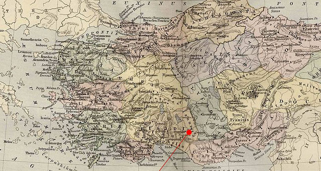
English: Asia Minor.
|
| Tarih | (UTC) |
| Kaynak | |
| Yazar |
|
| Bu rötuşlanmış bir resim olup, resmin özgün hâli üzerinde oynama yapılarak elde edilmiştir. Yapılan değişiklikler: Cropping and red pointer added to show location of Isauria.Resmin özgün hâline şuradan erişilebilir: Asia Minor Map, Classical Atlas, 1886, Keith Johnston.jpg. Resimdeki düzenlemeler Polylerus tarafından yapılmıştır.
|
|
Bu çalışma ABD'de veya yazarın yaşamının sona ermiş olmasından 70 veya daha fazla süre geçtiğinde bu duruma uygun telif yasaları olan tüm ülkelerde kamu malıdır.
| |
| Bu dosya ve ilgili diğer hakları da dahil olmak üzere telif hakkı kapsamında bilinen tüm kısıtlamalar, serbest lisans olarak belirlenmiştir. | |
Orijinal yükleme günlüğü
This image is a derivative work of the following images:
- File:Asia_Minor_Map,_Classical_Atlas,_1886,_Keith_Johnston.jpg licensed with Cc-pd-mark-footer, PD-old
- 2009-12-03T21:05:42Z Jssfrk 3669x2824 (938691 Bytes) {{Information |Description={{en|1=Asia Minor. Including Pontus, Cappadocia, Cilicia, Pisidia, Lycia, Caria, Lydia, Mysia, Bithynia, Paphlagonia, Phrygia, and Crete. "These color maps are 11" x 13.5" when printed at 300dpi. T
Uploaded with derivativeFX
Dosya geçmişi
Dosyanın herhangi bir zamandaki hâli için ilgili tarih/saat kısmına tıklayın.
| Tarih/Saat | Küçük resim | Boyutlar | Kullanıcı | Yorum | |
|---|---|---|---|---|---|
| güncel | 23.23, 23 Ocak 2011 | | 637 × 340 (112 KB) | Polylerus | {{Information |Description={{en|1=Asia Minor. Including Pontus, Cappadocia, Cilicia, Pisidia, Lycia, Caria, Lydia, Mysia, Bithynia, Paphlagonia, Phrygia, and Crete. "These color maps are 11" x 13.5" when printed at 300dpi. They were copied from an origin |
Dosya kullanımı
Bu görüntü dosyasına bağlantısı olan sayfalar:
Küresel dosya kullanımı
Aşağıdaki diğer vikiler bu dosyayı kullanır:
- bcl.wikipedia.org üzerinde kullanımı
- cs.wikipedia.org üzerinde kullanımı
- de.wikipedia.org üzerinde kullanımı
- en.wikipedia.org üzerinde kullanımı
- es.wikipedia.org üzerinde kullanımı
- eu.wikipedia.org üzerinde kullanımı
- hy.wikipedia.org üzerinde kullanımı
- id.wikipedia.org üzerinde kullanımı
- pl.wikipedia.org üzerinde kullanımı
- pt.wikipedia.org üzerinde kullanımı
- ro.wikipedia.org üzerinde kullanımı
- sh.wikipedia.org üzerinde kullanımı
- sl.wikipedia.org üzerinde kullanımı