
Dosya:FrancoPrussianWar5to6Aug1870.jpg
Tam çözünürlük ((1.083 × 928 piksel, dosya boyutu: 1,15 MB, MIME tipi: image/jpeg))
Bu dosya Wikimedia Commons'ta bulunmaktadır. Dosyanın açıklaması aşağıda gösterilmiştir. Commons, serbest/özgür telifli medya dosyalarının bulundurulduğu depodur. Siz de yardım edebilirsiniz. |
Özet
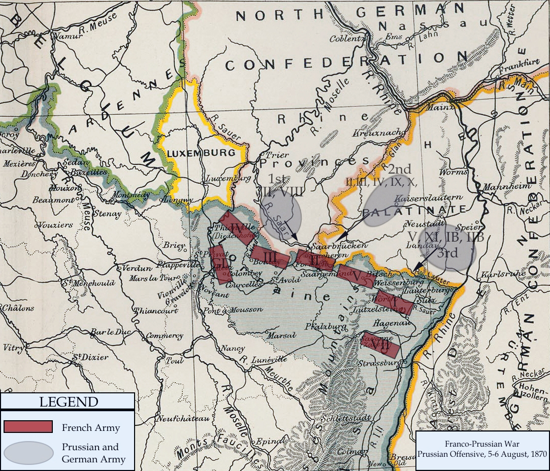
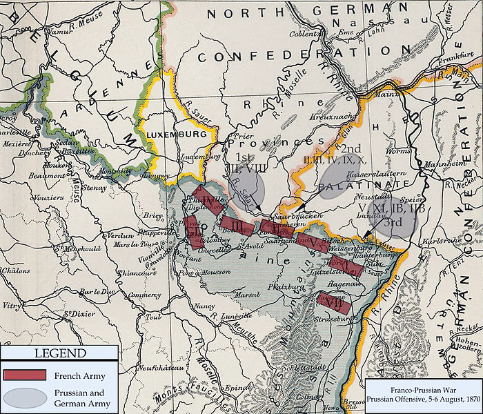
| Açıklama | Franco-Prussian War map of 1870 | |||||
| Tarih | ||||||
| Kaynak | Cambridge Modern History Atlas | |||||
| Yazar | Edited by A.W.Ward, G.W.Prothero, and Stanley Leathes | |||||
| İzin (Bu dosyanın tekrar kullanımı) |
|

I adapted the map to reflect the state of French and Prussian/German armies from 5 to 6 August, 1870. Information for the armies was obtained from Wawro, Geoffrey (2003) The Franco-Prussian War: The German Conquest of France in 1870-1871, Cambridge University Press ISBN: 0-521-58436-1.
Dosya geçmişi
Dosyanın herhangi bir zamandaki hâli için ilgili tarih/saat kısmına tıklayın.
| Tarih/Saat | Küçük resim | Boyutlar | Kullanıcı | Yorum | |
|---|---|---|---|---|---|
| güncel | 20.13, 15 Şubat 2011 | | 1.083 × 928 (1,15 MB) | DIREKTOR | Repairs |
| 20.57, 3 Ocak 2008 |  | 1.083 × 928 (1,04 MB) | Monsieurdl | == Summary == {{Information |Description=Franco-Prussian War map of 1870 |Source=Cambridge Modern History Atlas |Date=1912 |Author=Edited by A.W.Ward, G.W.Prothero, and Stanley Leathes }} I adapted the map to reflect the state of French and Prussian/Germ |
Dosya kullanımı
Bu görüntü dosyasına bağlantısı olan sayfalar:
Küresel dosya kullanımı
Aşağıdaki diğer vikiler bu dosyayı kullanır:
- azb.wikipedia.org üzerinde kullanımı
- bg.wikipedia.org üzerinde kullanımı
- ca.wikipedia.org üzerinde kullanımı
- en.wikipedia.org üzerinde kullanımı
- hu.wikipedia.org üzerinde kullanımı
- hy.wikipedia.org üzerinde kullanımı
- ja.wikipedia.org üzerinde kullanımı
- vi.wikipedia.org üzerinde kullanımı