
Dosya:France all regions.svg

Bu SVG dosyasının PNG önizlemesinin boyutu: 386 × 296 piksel. Diğer çözünürlükler: 313 × 240 piksel | 626 × 480 piksel | 1.002 × 768 piksel | 1.280 × 982 piksel | 2.560 × 1.963 piksel.
Tam çözünürlük (SVG dosyası, sözde 386 × 296 piksel, dosya boyutu: 152 KB)
Bu dosya Wikimedia Commons'ta bulunmaktadır. Dosyanın açıklaması aşağıda gösterilmiştir. Commons, serbest/özgür telifli medya dosyalarının bulundurulduğu depodur. Siz de yardım edebilirsiniz. |
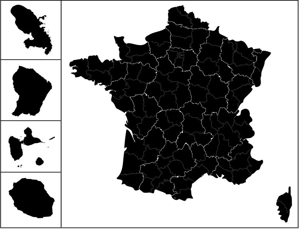
| Açıklama | carte des regions de france avec l'outre-mers |
| Tarih | (UTC) |
| Kaynak | |
| Yazar |
|
| Bu rötuşlanmış bir resim olup, resmin özgün hâli üzerinde oynama yapılarak elde edilmiştir. Resmin özgün hâline şuradan erişilebilir: Communes-guyane-blank.svg.
|
Bu dosya, Creative Commons Atıf-Benzer Paylaşım 3.0 Taşınmamış lisansı ile lisanslanmıştır
- Şu seçeneklerde özgürsünüz:
- paylaşım – eser paylaşımı, dağıtımı ve iletimi
- içeriği değiştirip uyarlama – eser adaptasyonu
- Aşağıdaki koşullar geçerli olacaktır:
- atıf – Esere yazar veya lisans sahibi tarafından belirtilen (ancak sizi ya da eseri kullanımınızı desteklediklerini ileri sürmeyecek bir) şekilde atıfta bulunmalısınız.
- benzer paylaşım – Maddeyi yeniden karıştırır, dönüştürür veya inşa ederseniz, katkılarınızı orijinal olarak aynı veya uyumlu lisans altında dağıtmanız gerekir.
Orijinal yükleme günlüğü
This image is a derivative work of the following images:
- File:France_location_map-Regions_and_departements.svg licensed with Cc-by-sa-3.0,2.5,2.0,1.0, GFDL
- 2009-02-02T16:12:50Z Yug 2000x1922 (772026 Bytes) Restore light style version ; a specific file name will be use for polygon departement maps.
- 2009-02-01T19:34:09Z Yug 2000x1922 (1849428 Bytes) restore East and southern border deleted by mistake + code improving.
- 2009-02-01T14:41:40Z Yug 2000x1922 (1852045 Bytes) Statistic friendly added, as an upper layer.
- 2008-11-07T13:23:10Z Sting 2000x1922 (772026 Bytes) + boundary for Channel Islands
- 2008-08-23T16:29:48Z Sting 2000x1922 (769918 Bytes) Larger strokes for boundaries
- 2008-07-25T17:35:54Z Sting 2000x1922 (770878 Bytes) Display bug
- 2008-07-25T17:28:38Z Sting 2000x1922 (772649 Bytes) Variable scale
- 2008-07-25T14:29:27Z Sting 2000x1922 (773101 Bytes) - border
- 2008-07-25T14:23:11Z Sting 2000x1922 (773214 Bytes) Other countries' color
- 2008-07-04T20:32:47Z Sting 2000x1922 (772973 Bytes) == Summary == {{Location|46|15|00|N|02|06|00|E|scale:10000000}} {{Information |Description={{en|Blank administrative map of [[:en:France|France]] for geo-location purpose, with regions and departements distinguished.Approxim
- File:Réunion_communes.svg licensed with Cc-by-sa-2.5,2.0,1.0, GFDL
- 2007-03-10T18:48:13Z Kimdime69 699x610 (491125 Bytes) {{Information |Description=Communes de l'île de la Réunion (France) |Source=Own creation based on[[:Image:Réunion-communes.png]] |Date=2007 |Author=[[User:Kimdime69]] |Permission= |other_versions= }} [[Category:Maps of Ré
- 2007-03-10T18:47:14Z Kimdime69 699x610 (491125 Bytes) {{Information |Description=Communes de l'île de la Réunion (France) |Source=Own creation based on[[:Image:Réunion-communes.png]] |Date=2007 |Author=[[User:Kimdime69]] |Permission= |other_versions= }} [[Category:Maps of Ré
- File:Guadeloupe_department_location_map.svg licensed with Cc-by-sa-3.0, GFDL
- 2008-09-22T20:00:26Z Sting 1015x890 (221742 Bytes) == Summary == {{Location|16|10|30|N|61|24|00|W|scale:500000}} {{Information |Description={{en|Blank administrative map of the region and department of [[:en:Guadeloupe|Guadeloupe]], France, for geo-location purpose, with arr
- File:Martinique_department_location_map.svg licensed with Cc-by-sa-3.0, GFDL
- 2008-08-16T20:46:56Z Sting 961x1112 (134399 Bytes) == Summary == {{Location|14|39|00|N|61|00|45|W|scale:500000}} {{Information |Description={{en|Blank administrative map of the region and department of [[:en:Martinique|Martinique]], France, for geo-location purpose, with arr
- File:Communes-guyane-blank.svg licensed with Cc-by-sa-2.5,2.0,1.0, GFDL
- 2007-04-04T21:56:28Z Kimdime69 587x729 (119711 Bytes) {{Information |Description=Communes of the french region and departement of Guyane |Source=own creation based on [http://www.cries-guyane.fr/upload/actus_42e7c4ec8679d.pdf] |Date=2007 |Author={{u|Kimdime69}} |Permission= |oth
Uploaded with derivativeFX
Dosya geçmişi
Dosyanın herhangi bir zamandaki hâli için ilgili tarih/saat kısmına tıklayın.
| Tarih/Saat | Küçük resim | Boyutlar | Kullanıcı | Yorum | |
|---|---|---|---|---|---|
| güncel | 12.56, 25 Nisan 2009 | | 386 × 296 (152 KB) | 3dsman | {{Information |Description=carte des regions de france avec l'outre-mers |Source=*File:France_location_map-Regions_and_departements.svg *File:Réunion_communes.svg *File:Guadeloupe_department_location_map.svg *[[:File:Martinique_departme |
Dosya kullanımı
Bu görüntü dosyasına bağlanan sayfa yok.