
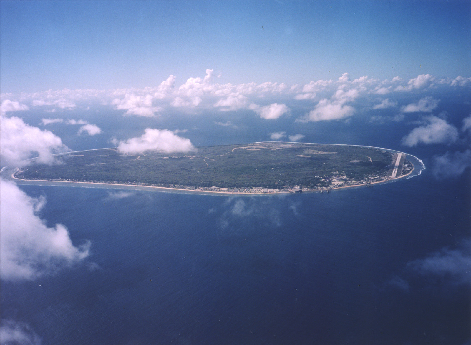
Dosya:Aerial view of Nauru.jpg
Bu önizlemenin boyutu: 800 × 587 piksel. Diğer çözünürlükler: 320 × 235 piksel | 640 × 469 piksel | 1.024 × 751 piksel | 1.280 × 938 piksel | 1.600 × 1.173 piksel.
Tam çözünürlük ((1.600 × 1.173 piksel, dosya boyutu: 545 KB, MIME tipi: image/jpeg))
Bu dosya Wikimedia Commons'ta bulunmaktadır. Dosyanın açıklaması aşağıda gösterilmiştir. Commons, serbest/özgür telifli medya dosyalarının bulundurulduğu depodur. Siz de yardım edebilirsiniz. |
Özet
| Açıklama |
English: A limestone karst on Nauru Island as a result of the over-mining of phosphate. |
| Tarih | |
| Kaynak | https://www.flickr.com/photos/armgov/4708951747/ |
| Yazar | U.S. Department of Energy's Atmospheric Radiation Measurement Program |
Lisanslama
This photograph was produced by the Atmospheric Radiation Measurement Program.
Their site states:
|
Dosya geçmişi
Dosyanın herhangi bir zamandaki hâli için ilgili tarih/saat kısmına tıklayın.
| Tarih/Saat | Küçük resim | Boyutlar | Kullanıcı | Yorum | |
|---|---|---|---|---|---|
| güncel | 22.53, 28 Nisan 2023 | | 1.600 × 1.173 (545 KB) | Auguel | Cropped 1 % vertically using CropTool with lossless mode. |
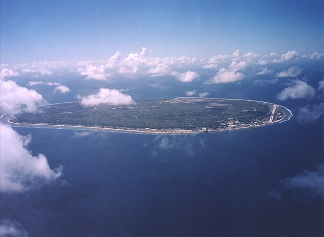
| 02.13, 3 Nisan 2007 |  | 1.600 × 1.187 (401 KB) | Indolences | A limestone karst on Nauru Island as a result of the over-mining of phosphate. ''Courtesy: U.S. Department of Energy's Atmospheric Radiation Measurement Program.'' Source: [http://images.arm.gov/armimages.nsf/by+id/TENG-5JGSKP] (http://www.arm.gov/) {{ |
Dosya kullanımı
Bu görüntü dosyasına bağlantısı olan sayfalar:
Küresel dosya kullanımı
Aşağıdaki diğer vikiler bu dosyayı kullanır:
- ar.wikipedia.org üzerinde kullanımı
- as.wikipedia.org üzerinde kullanımı
- bg.wikipedia.org üzerinde kullanımı
- de.wikipedia.org üzerinde kullanımı
- dsb.wikipedia.org üzerinde kullanımı
- en.wikipedia.org üzerinde kullanımı
- en.wikiversity.org üzerinde kullanımı
- es.wikipedia.org üzerinde kullanımı
- fr.wikipedia.org üzerinde kullanımı
- fr.wiktionary.org üzerinde kullanımı
- he.wikivoyage.org üzerinde kullanımı
- hsb.wikipedia.org üzerinde kullanımı
- hu.wikipedia.org üzerinde kullanımı
- hy.wikipedia.org üzerinde kullanımı
- id.wikipedia.org üzerinde kullanımı
- incubator.wikimedia.org üzerinde kullanımı
- lv.wikipedia.org üzerinde kullanımı
- ms.wikipedia.org üzerinde kullanımı
- na.wikipedia.org üzerinde kullanımı
- nl.wikivoyage.org üzerinde kullanımı
- pl.wikipedia.org üzerinde kullanımı
- pt.wikivoyage.org üzerinde kullanımı
- ru.wikipedia.org üzerinde kullanımı
- ru.wikivoyage.org üzerinde kullanımı
- simple.wikipedia.org üzerinde kullanımı
- si.wikipedia.org üzerinde kullanımı
- ta.wikipedia.org üzerinde kullanımı
- test.wikipedia.org üzerinde kullanımı
- th.wikipedia.org üzerinde kullanımı
- uk.wikipedia.org üzerinde kullanımı
- vec.wikipedia.org üzerinde kullanımı
- vi.wikipedia.org üzerinde kullanımı
- vi.wikivoyage.org üzerinde kullanımı