
Dosya:USA Counties.svg

Bu SVG dosyasının PNG önizlemesinin boyutu: 555 × 352 piksel. Diğer çözünürlükler: 320 × 203 piksel | 640 × 406 piksel | 1.024 × 649 piksel | 1.280 × 812 piksel | 2.560 × 1.624 piksel.
Tam çözünürlük (SVG dosyası, sözde 555 × 352 piksel, dosya boyutu: 1,11 MB)
Bu dosya Wikimedia Commons'ta bulunmaktadır. Dosyanın açıklaması aşağıda gösterilmiştir. Commons, serbest/özgür telifli medya dosyalarının bulundurulduğu depodur. Siz de yardım edebilirsiniz. |

|
Bu dosya'nın yerine yeni versiyonu olan File:Usa counties large.svg'ı kullanınız. Bu diğer dosyanın kullanılması önerilir. Sebep: Contains county names and county codes in the svg code
|

|
| Açıklama |
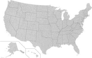
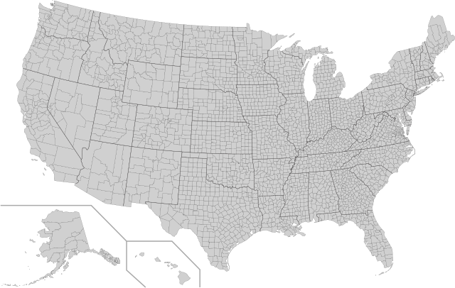
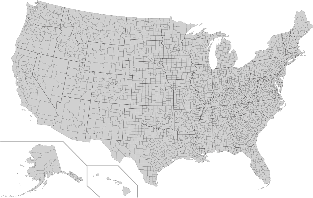
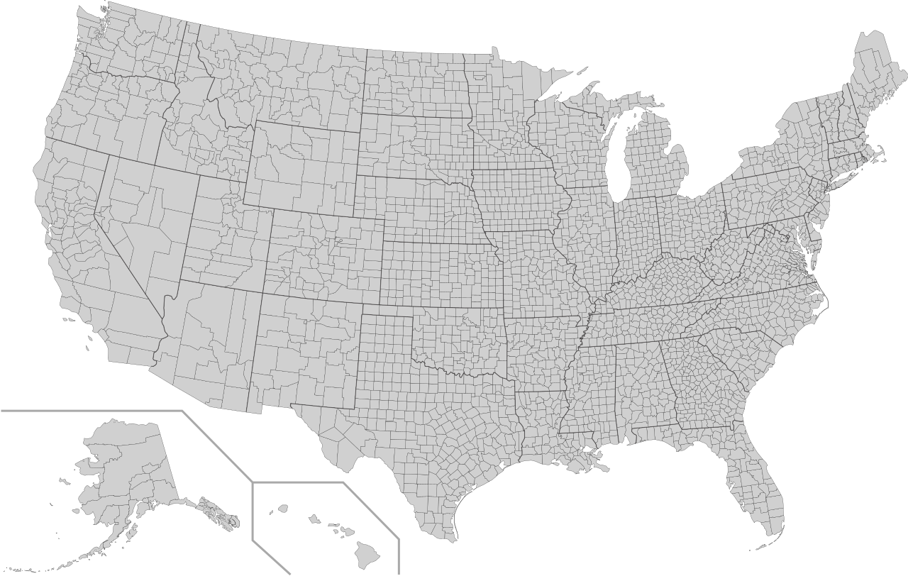
English: This is a map of the United States showing the borders of states and counties in high detail. |
|||
| Kaynak |
It was derived from this public-domain document published by the U.S. Census Bureau. |
|||
| Yazar | U.S. Census Bureau | |||
| İzin (Bu dosyanın tekrar kullanımı) |
|
|||
| Diğer sürümler | Bu dosyanın türev çalışmaları: Usa counties large.svg | |||
| SVG gelişimi | Bu SVG kaynak kodu geçerlidir. Bu vektörel grafik Inkscape ile oluşturuldu. |

Dosya geçmişi
Dosyanın herhangi bir zamandaki hâli için ilgili tarih/saat kısmına tıklayın.
| Tarih/Saat | Küçük resim | Boyutlar | Kullanıcı | Yorum | |
|---|---|---|---|---|---|
| güncel | 05.18, 10 Ağustos 2022 | | 555 × 352 (1,11 MB) | DemonDays64 | Fixed some problems: merged southern part of Unorganized Alaska into one shape; properly labeled Somerset MD, which Accomack VA had been mislabeled as |
| 06.22, 17 Eylül 2020 |  | 555 × 352 (1,11 MB) | DemonDays64 | Fixed misspelling of "Albemarle" as "Albermarle" | |
| 15.56, 10 Eylül 2018 |  | 555 × 352 (1,11 MB) | JoKalliauer | restored id-names and css from 03:49, 26. Mär. 2016 | |
| 06.38, 30 Ağustos 2018 |  | 555 × 352 (670 KB) | JoKalliauer | Smaller file-size. Cleaner code. valid file | |
| 03.49, 26 Mart 2016 |  | 555 × 352 (1,58 MB) | Spesh531 | updating borders, more accurate | |
| 15.47, 23 Aralık 2007 |  | 555 × 352 (2,03 MB) | Lokal Profil | Fixed state borders and fixed the two parts of Fulton County (Kentucky) | |
| 02.20, 10 Aralık 2007 |  | 555 × 352 (2,04 MB) | Lokal Profil | Graphical and code cleanup | |
| 01.15, 10 Aralık 2007 |  | 792 × 612 (2,04 MB) | Lokal Profil | First stab at a code cleanup | |
| 00.14, 29 Ağustos 2006 |  | 792 × 612 (2,71 MB) | Petr Dlouhý | Original file: en:Image:USA CountiesSVG.zip This ZIP file contains an SVG map of the United States showing the borders of states and counties in high detail. It was derived from [http://www2.census.gov/geo/maps/special |
Dosya kullanımı
Bu görüntü dosyasına bağlantısı olan sayfalar:
Küresel dosya kullanımı
Aşağıdaki diğer vikiler bu dosyayı kullanır:
- af.wikipedia.org üzerinde kullanımı
- en.wikipedia.org üzerinde kullanımı
- fa.wikipedia.org üzerinde kullanımı
- fi.wikipedia.org üzerinde kullanımı
- he.wikipedia.org üzerinde kullanımı
- hi.wikipedia.org üzerinde kullanımı
- hu.wikipedia.org üzerinde kullanımı
- io.wikipedia.org üzerinde kullanımı
- pnb.wikipedia.org üzerinde kullanımı
- pt.wikipedia.org üzerinde kullanımı
- ro.wikipedia.org üzerinde kullanımı
- sh.wikipedia.org üzerinde kullanımı
- sq.wikipedia.org üzerinde kullanımı
- sr.wikipedia.org üzerinde kullanımı
- ur.wikipedia.org üzerinde kullanımı