
Dosya:NPS pinnacles-map.jpg

Bu önizlemenin boyutu: 461 × 599 piksel. Diğer çözünürlükler: 185 × 240 piksel | 369 × 480 piksel | 591 × 768 piksel | 788 × 1.024 piksel | 1.862 × 2.420 piksel.
Tam çözünürlük ((1.862 × 2.420 piksel, dosya boyutu: 600 KB, MIME tipi: image/jpeg))
Bu dosya Wikimedia Commons'ta bulunmaktadır. Dosyanın açıklaması aşağıda gösterilmiştir. Commons, serbest/özgür telifli medya dosyalarının bulundurulduğu depodur. Siz de yardım edebilirsiniz. |
Özet
| Açıklama |
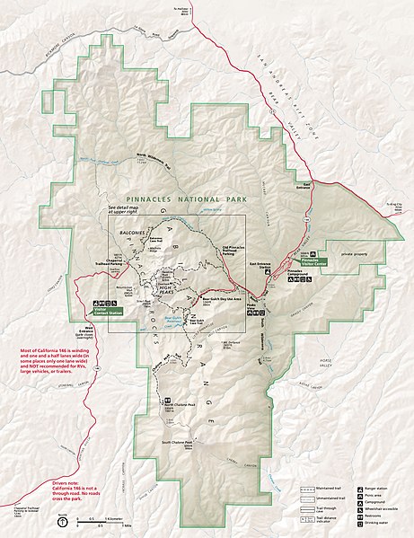
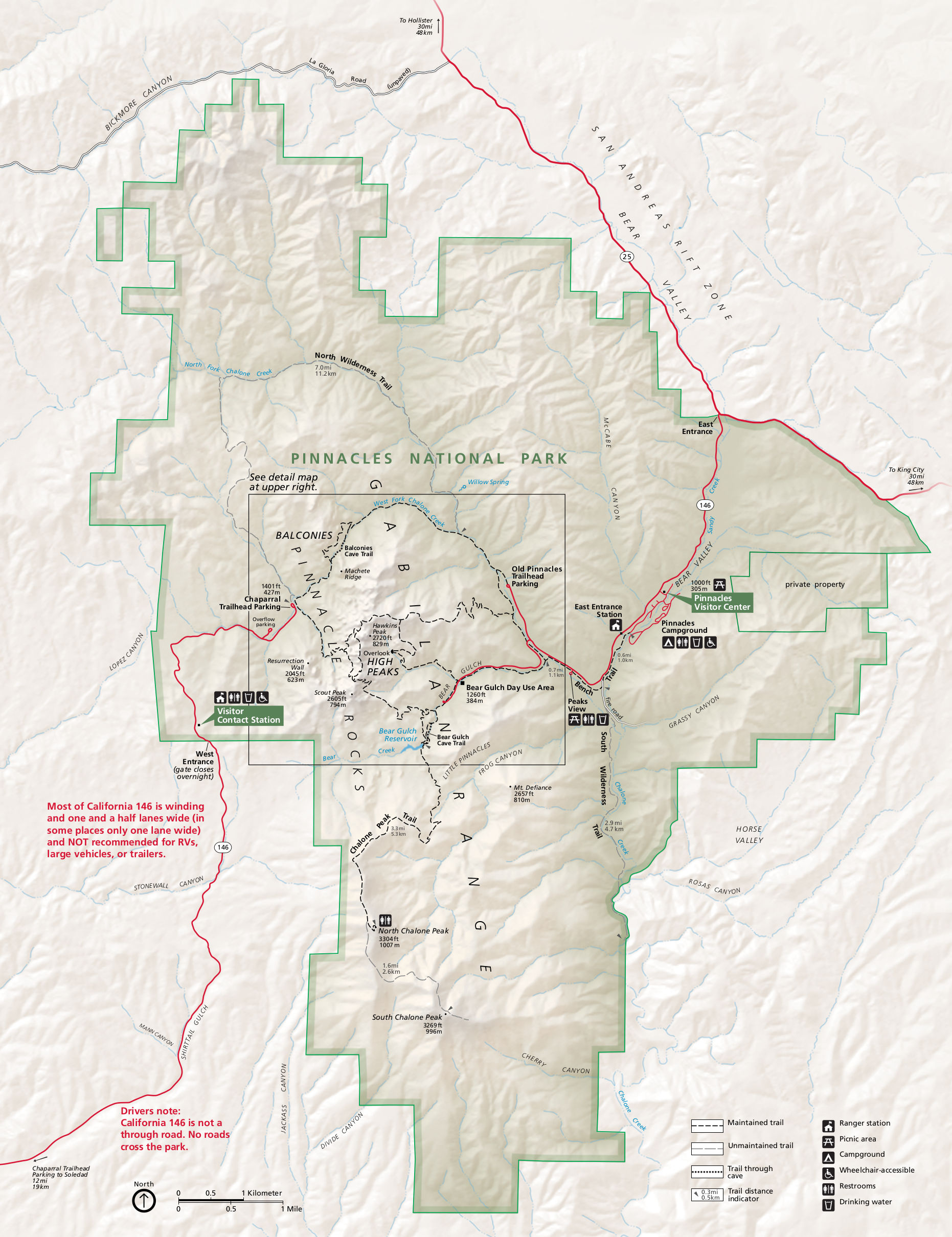
English: Main Pinnacles National Park map, showing roads, hiking trails, campgrounds, visitor centers, and points of interest. |
| Tarih | |
| Kaynak | U.S. National Park Service (http://npmaps.com/wp-content/uploads/pinnacles-map.jpg) |
| Yazar | U.S. National Park Service, restoration/cleanup by Matt Holly |
| Diğer sürümler |
 |
Lisanslama
| This image or media file contains material based on a work of a National Park Service employee, created as part of that person's official duties. As a work of the U.S. federal government, such work is in the public domain in the United States. See the NPS website and NPS copyright policy for more information. |
Dosya geçmişi
Dosyanın herhangi bir zamandaki hâli için ilgili tarih/saat kısmına tıklayın.
| Tarih/Saat | Küçük resim | Boyutlar | Kullanıcı | Yorum | |
|---|---|---|---|---|---|
| güncel | 01.52, 17 Mayıs 2017 | | 1.862 × 2.420 (600 KB) | RKBot | =={{int:filedesc}}== {{Information |description= {{en|1=Main Pinnacles National Park map, showing roads, hiking trails, campgrounds, visitor centers, and points of interest.}} |date= 2015-08-14 |source= U.S. National Park Service (http://npmaps.com/wp-... |
Dosya kullanımı
Bu görüntü dosyasına bağlantısı olan sayfalar:
Küresel dosya kullanımı
Aşağıdaki diğer vikiler bu dosyayı kullanır:
- en.wikipedia.org üzerinde kullanımı
- es.wikipedia.org üzerinde kullanımı
- eu.wikipedia.org üzerinde kullanımı
- he.wikipedia.org üzerinde kullanımı
- nl.wikipedia.org üzerinde kullanımı
- pl.wikipedia.org üzerinde kullanımı