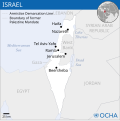
Dosya:Israel - Location Map (2012) - ISR - UNOCHA.svg

Bu SVG dosyasının PNG önizlemesinin boyutu: 250 × 250 piksel. Diğer çözünürlükler: 240 × 240 piksel | 480 × 480 piksel | 768 × 768 piksel | 1.024 × 1.024 piksel | 2.048 × 2.048 piksel.
Tam çözünürlük (SVG dosyası, sözde 250 × 250 piksel, dosya boyutu: 141 KB)
Dosya geçmişi
Dosyanın herhangi bir zamandaki hâli için ilgili tarih/saat kısmına tıklayın.
| Tarih/Saat | Küçük resim | Boyutlar | Kullanıcı | Yorum | |
|---|---|---|---|---|---|
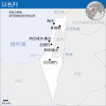
| güncel | 08.26, 8 Ekim 2023 |  | 250 × 250 (141 KB) | Trần Nguyễn Minh Huy | File uploaded using svgtranslate tool (https://svgtranslate.toolforge.org/). Added translation for vi. |
| 06.39, 27 Temmuz 2022 |  | 250 × 250 (140 KB) | Enkhsaihan2005 | File uploaded using svgtranslate tool (https://svgtranslate.toolforge.org/). Added translation for mn. | |
| 06.38, 27 Temmuz 2022 |  | 250 × 250 (139 KB) | Enkhsaihan2005 | File uploaded using svgtranslate tool (https://svgtranslate.toolforge.org/). Added translation for mn. | |
| 01.48, 28 Mart 2022 |  | 250 × 250 (136 KB) | Nyilvoskt | File uploaded using svgtranslate tool (https://svgtranslate.toolforge.org/). Added translation for id. | |
| 15.21, 17 Şubat 2022 |  | 250 × 250 (134 KB) | Kurmanbek | File uploaded using svgtranslate tool (https://svgtranslate.toolforge.org/). Added translation for tr. | |
| 22.27, 17 Şubat 2016 |  | 250 × 250 (130 KB) | Wereldburger758 | Resized page to drawing. Removal watermark. Validation of image. | |
| 03.21, 19 Ağustos 2014 |  | 250 × 250 (185 KB) | Pharos | == {{int:filedesc}} == {{Information |description={{en|1=Locator map of Chile.}} |date=2013 |source={{en|1=[http://reliefweb.int/map/chile/chile-location-map-2013 Chile Locator Map (ReliefWeb)]}} |author={{en|1=[[w:en:United Nations Offi... |
Dosya kullanımı
Bu görüntü dosyasına bağlantısı olan sayfalar:
Küresel dosya kullanımı
Aşağıdaki diğer vikiler bu dosyayı kullanır:
- ar.wikipedia.org üzerinde kullanımı
- az.wikipedia.org üzerinde kullanımı
- ban.wikipedia.org üzerinde kullanımı
- bcl.wikipedia.org üzerinde kullanımı
- bh.wikipedia.org üzerinde kullanımı
- blk.wikipedia.org üzerinde kullanımı
- bxr.wikipedia.org üzerinde kullanımı
- dty.wikipedia.org üzerinde kullanımı
- en.wikipedia.org üzerinde kullanımı
- es.wikipedia.org üzerinde kullanımı
- eu.wikipedia.org üzerinde kullanımı
- fa.wikipedia.org üzerinde kullanımı
- fr.wikipedia.org üzerinde kullanımı
- gu.wikipedia.org üzerinde kullanımı
- hy.wikipedia.org üzerinde kullanımı
- id.wikipedia.org üzerinde kullanımı
- incubator.wikimedia.org üzerinde kullanımı
- ka.wikipedia.org üzerinde kullanımı
- lo.wikipedia.org üzerinde kullanımı
- ml.wikipedia.org üzerinde kullanımı
- mn.wikipedia.org üzerinde kullanımı
- mzn.wikipedia.org üzerinde kullanımı
- ne.wikipedia.org üzerinde kullanımı
- nso.wikipedia.org üzerinde kullanımı
- pa.wikipedia.org üzerinde kullanımı
- pnb.wikipedia.org üzerinde kullanımı
- ps.wikipedia.org üzerinde kullanımı
- ro.wikipedia.org üzerinde kullanımı
- ru.wikipedia.org üzerinde kullanımı
- sco.wikipedia.org üzerinde kullanımı
- sd.wikipedia.org üzerinde kullanımı
- si.wikipedia.org üzerinde kullanımı
- sl.wikipedia.org üzerinde kullanımı
- sq.wikipedia.org üzerinde kullanımı
- su.wikipedia.org üzerinde kullanımı
- tcy.wikipedia.org üzerinde kullanımı
- te.wikipedia.org üzerinde kullanımı
- th.wikipedia.org üzerinde kullanımı
- to.wikipedia.org üzerinde kullanımı
Bu dosyanın daha fazla küresel kullanımını görüntüle.


