Dosya:Croton dam Brian.H Flickr 102843790 9ae9b1a96d o.jpg

Sayfa içeriği diğer dillerde desteklenmemektedir.
Vikipedi, özgür ansiklopedi

Croton_dam_Brian.H_Flickr_102843790_9ae9b1a96d_o.jpg((800 × 594 piksel, dosya boyutu: 96 KB, MIME tipi: image/jpeg))


Özet

Kamera pozisyonu43° 26′ 14,1″ K, 85° 39′ 50,25″ B Kartographer map based on OpenStreetMap.Bu ve diğer görüntülerin konumlarını şurada belirle: OpenStreetMapinfo
Açıklama

(by Brian.H, from the Flickr page)

Combo of three handheld images. The left-hand side of this shows where the s/w couldn't match everything up quite right. I really have to remember to throw my tripod in the car! At least I don't forget the camera when I leave the house :)
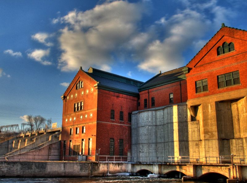
From the historical marker: The Croton Hydroelectric Generating Dam began operation in 1907. It is capable of generating 8,800 kilowatts of electricity, enough to serve a community of about 4,900 people. The plant is located in Newaygo County’s Croton Township.

(by user:Lar)

Croton Dam is a dam and powerplant complex on the Muskegon River in Croton Township, Newaygo County, Michigan, operated by Consumers Energy. This composite was created from images taken from the downstream side, to the SE of the powerhouse. This image is near the E end of the dam, at location A on the locator, facing NW
Tarih
Kaynak Croton Dam
Yazar Brian from Michigan, USA ... uploaded by User:Lar
İzin
(Bu dosyanın tekrar kullanımı)
see cc-by-2.0 below
Map of area

Lisanslama

w:tr:Creative Commons
atıf
Bu dosya, Creative Commons Atıf 2.0 Genel lisansı ile lisanslanmıştır
Şu seçeneklerde özgürsünüz:
  • paylaşım – eser paylaşımı, dağıtımı ve iletimi
  • içeriği değiştirip uyarlama – eser adaptasyonu
Aşağıdaki koşullar geçerli olacaktır:
  • atıf – Esere yazar veya lisans sahibi tarafından belirtilen (ancak sizi ya da eseri kullanımınızı desteklediklerini ileri sürmeyecek bir) şekilde atıfta bulunmalısınız.
Özgün hali Flickr'de yayınlanan bu resim, Septemeber 9, 2007 tarihinde bir hizmetli veya lisans inceleyicisi Lar tarafından, Flickr'da o tarihte belirtilen lisans altında yayınlandığı incelendi.

Altyazılar

Bu dosyanın temsil ettiği şeyin tek satırlık açıklamasını ekleyin.

Bu dosyada gösterilen öğeler

betimlenen

43°26'14.100"N, 85°39'50.245"W

21 Şubat 2006

Dosya geçmişi

Dosyanın herhangi bir zamandaki hâli için ilgili tarih/saat kısmına tıklayın.

Tarih/SaatKüçük resimBoyutlarKullanıcıYorum
güncel16.30, 9 Eylül 200716.30, 9 Eylül 2007 tarihindeki sürümün küçültülmüş hâli800 × 594 (96 KB)Lar{{Information |Description=(by Brian.H, from the Flickr page) Combo of three handheld images. The left-hand side of this shows where the s/w couldn't match everything up quite right. I really have to remember to throw my tripod in the car! At least I d

Bu görüntü dosyasına bağlanan sayfa yok.

Küresel dosya kullanımı

Aşağıdaki diğer vikiler bu dosyayı kullanır:

Meta veri