
Dosya:4516-Oxford-map-1510x1384.jpg
Tam çözünürlük ((1.510 × 1.384 piksel, dosya boyutu: 506 KB, MIME tipi: image/jpeg))
Bu dosya Wikimedia Commons'ta bulunmaktadır. Dosyanın açıklaması aşağıda gösterilmiştir. Commons, serbest/özgür telifli medya dosyalarının bulundurulduğu depodur. Siz de yardım edebilirsiniz. |
| Açıklama |
English: public domain image from http://fromoldbooks.org/HarmsworthEncyclopaedia/pages/4516-Oxford-map/1510x1384.html
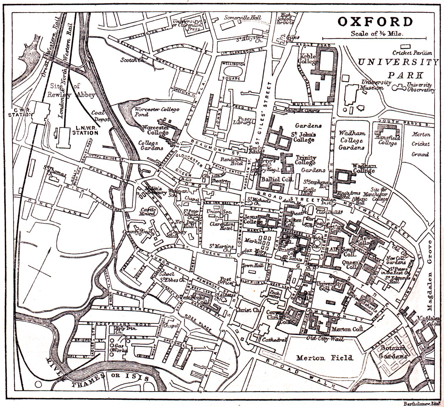
"Overview map of en:Oxford from 1900 or so, showing the en:River Thames of Isis, giving the names of almost all the streets, marking the colleges of en:Oxford University, the railway and other items." Note that Christ Church College is not shaded as a college, for unknown reasons. |
| Tarih | 21 Ekim 2005 (original upload date) |
| Kaynak | en.wikipedia üzerinden Commons'a transfer edildi. |
| Yazar | The original uploader was Roke at İngilizce Vikipedi. |
Lisanslama
|
Bu çalışma ABD'de veya yazarın yaşamının sona ermiş olmasından 70 veya daha fazla süre geçtiğinde bu duruma uygun telif yasaları olan tüm ülkelerde kamu malıdır.
| |
| Bu dosya ve ilgili diğer hakları da dahil olmak üzere telif hakkı kapsamında bilinen tüm kısıtlamalar, serbest lisans olarak belirlenmiştir. | |
Orijinal yükleme günlüğü
- 2005-10-21 01:32 Roke 1510×1384× (517778 bytes) public domain image from http://fromoldbooks.org/HarmsworthEncyclopaedia/pages/4516-Oxford-map/1510x1384.html
Dosya geçmişi
Dosyanın herhangi bir zamandaki hâli için ilgili tarih/saat kısmına tıklayın.
| Tarih/Saat | Küçük resim | Boyutlar | Kullanıcı | Yorum | |
|---|---|---|---|---|---|
| güncel | 22.34, 12 Mart 2009 | | 1.510 × 1.384 (506 KB) | Kordas | {{Information |Description={{en|public domain image from http://fromoldbooks.org/HarmsworthEncyclopaedia/pages/4516-Oxford-map/1510x1384.html "Overview map of en:Oxford from 1900 or so, showing the en:River Thames of Isis, giving the names of a |
Dosya kullanımı
Bu görüntü dosyasına bağlantısı olan sayfalar:
Küresel dosya kullanımı
Aşağıdaki diğer vikiler bu dosyayı kullanır: