
Dosya:Un-nepal.png

Tam çözünürlük ((3.038 × 2.257 piksel, dosya boyutu: 1,56 MB, MIME tipi: image/png))
Bu dosya Wikimedia Commons'ta bulunmaktadır. Dosyanın açıklaması aşağıda gösterilmiştir. Commons, serbest/özgür telifli medya dosyalarının bulundurulduğu depodur. Siz de yardım edebilirsiniz. |
Özet
| Açıklama |
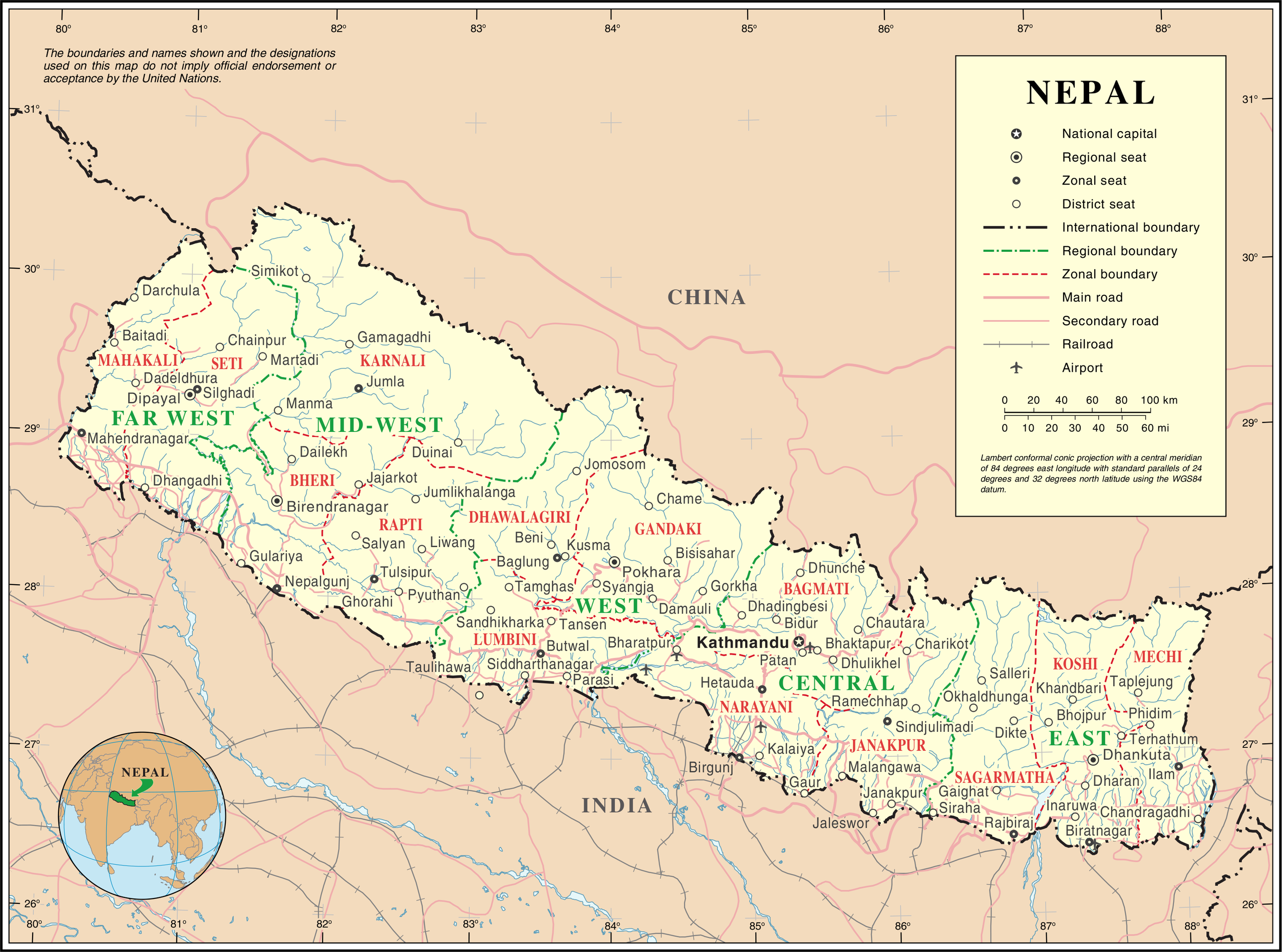
English: Map of Nepal highlighting development regions (green) and administrative zones (red), both disestablished in 2015 |
|||
| Tarih | before 25 Ekim 2007 | |||
| Kaynak | United Nations | |||
| Yazar | Bilinmiyor | |||
| İzin (Bu dosyanın tekrar kullanımı) |
|

Dosya geçmişi
Dosyanın herhangi bir zamandaki hâli için ilgili tarih/saat kısmına tıklayın.
| Tarih/Saat | Küçük resim | Boyutlar | Kullanıcı | Yorum | |
|---|---|---|---|---|---|
| güncel | 01.36, 24 Ekim 2007 | | 3.038 × 2.257 (1,56 MB) | Jeroen | {{UN map}} Category:Maps of Nepal |
Dosya kullanımı
Bu görüntü dosyasına bağlantısı olan sayfalar:
Küresel dosya kullanımı
Aşağıdaki diğer vikiler bu dosyayı kullanır:
- af.wikipedia.org üzerinde kullanımı
- az.wikipedia.org üzerinde kullanımı
- ba.wikipedia.org üzerinde kullanımı
- bh.wikipedia.org üzerinde kullanımı
- ca.wikipedia.org üzerinde kullanımı
- de.wikipedia.org üzerinde kullanımı
- en.wikipedia.org üzerinde kullanımı
- fi.wikipedia.org üzerinde kullanımı
- fr.wikipedia.org üzerinde kullanımı
- hyw.wikipedia.org üzerinde kullanımı
- ja.wikipedia.org üzerinde kullanımı
- krc.wikipedia.org üzerinde kullanımı
- nl.wikipedia.org üzerinde kullanımı
- pap.wikipedia.org üzerinde kullanımı
- pcd.wikipedia.org üzerinde kullanımı
- pl.wiktionary.org üzerinde kullanımı
- roa-rup.wikipedia.org üzerinde kullanımı
- ru.wikipedia.org üzerinde kullanımı
- sco.wikipedia.org üzerinde kullanımı
- sl.wikipedia.org üzerinde kullanımı
- ta.wikipedia.org üzerinde kullanımı
- th.wikipedia.org üzerinde kullanımı
- uk.wikipedia.org üzerinde kullanımı
- ur.wikipedia.org üzerinde kullanımı
- www.wikidata.org üzerinde kullanımı
- xmf.wikipedia.org üzerinde kullanımı