
Dosya:Turkey Western. Lesbos, Dardanelles 1.JPG
Bu önizlemenin boyutu: 397 × 599 piksel. Diğer çözünürlükler: 159 × 240 piksel | 318 × 480 piksel | 508 × 768 piksel | 678 × 1.024 piksel | 2.008 × 3.032 piksel.
Tam çözünürlük ((2.008 × 3.032 piksel, dosya boyutu: 1,72 MB, MIME tipi: image/jpeg))
Bu dosya Wikimedia Commons'ta bulunmaktadır. Dosyanın açıklaması aşağıda gösterilmiştir. Commons, serbest/özgür telifli medya dosyalarının bulundurulduğu depodur. Siz de yardım edebilirsiniz. |
Özet
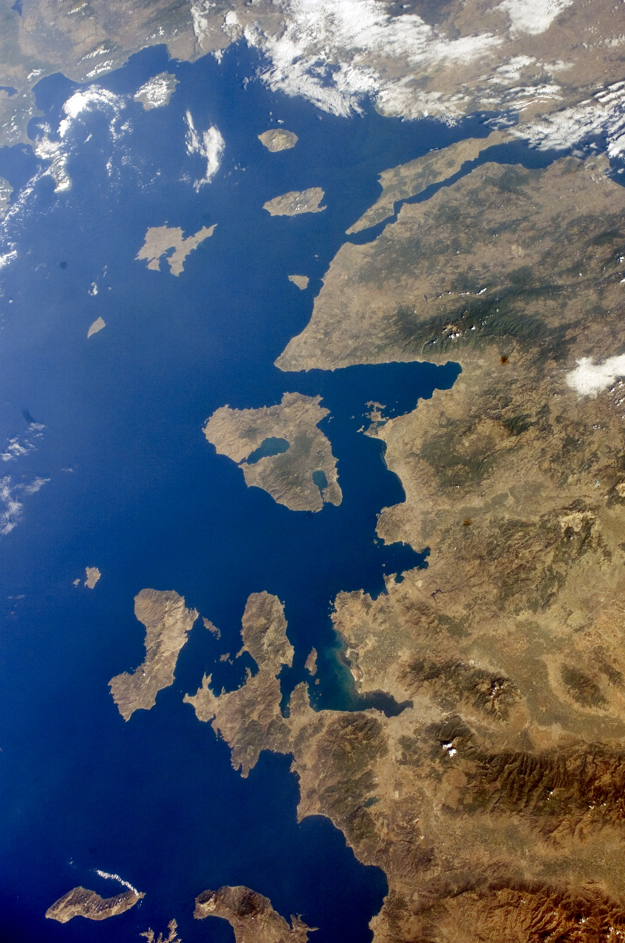
| Açıklama |
English: Turkey Western, Lesbos and Dardanelles.
Español: Noroeste de Turquía, Lesbos y Dardanelos. Mapa satelital de la Nasa (2005). |
| Tarih | |
| Kaynak | http://eol.jsc.nasa.gov/scripts/sseop/QuickView.pl?directory=ESC&ID=ISS011-E-13602 |
| Yazar | NASA |
| Diğer sürümler |


.JPG)
.JPG)
Lisanslama
This file is in the public domain in the United States because it was created by the Image Science & Analysis Laboratory, of the NASA Johnson Space Center. NASA copyright policy states that "NASA material is not protected by copyright unless noted". (NASA media use guidelines or Conditions of Use of Astronaut Photographs).
Photo source: ISS011-E-13602.
|
Dosya geçmişi
Dosyanın herhangi bir zamandaki hâli için ilgili tarih/saat kısmına tıklayın.
| Tarih/Saat | Küçük resim | Boyutlar | Kullanıcı | Yorum | |
|---|---|---|---|---|---|
| güncel | 22.52, 3 Ağustos 2014 | | 2.008 × 3.032 (1,72 MB) | Ras67 | new rendered from NASA's raw image data |
| 01.31, 18 Nisan 2010 |  | 423 × 639 (99 KB) | Dorieo | {{Information |Description={{en|1=Turkey Western, Lesbos and_Dardanelles.}} {{es|1=Noroeste de Turquía, Lesbos y Dardanelos. Mapa satelital de la Nasa (2005).}} |Source=http://eol.jsc.nasa.gov/scripts/sseop/QuickView.pl?directory=ESC&ID=ISS011-E-13602 |A |
Dosya kullanımı
Bu görüntü dosyasına bağlantısı olan sayfalar:
Küresel dosya kullanımı
Aşağıdaki diğer vikiler bu dosyayı kullanır:
- az.wikipedia.org üzerinde kullanımı
- ceb.wikipedia.org üzerinde kullanımı
- en.wikipedia.org üzerinde kullanımı
- es.wikipedia.org üzerinde kullanımı
- eu.wikipedia.org üzerinde kullanımı
- he.wikipedia.org üzerinde kullanımı
- hy.wikipedia.org üzerinde kullanımı
- it.wikipedia.org üzerinde kullanımı
- ku.wikipedia.org üzerinde kullanımı
- nn.wikipedia.org üzerinde kullanımı
- ru.wikipedia.org üzerinde kullanımı
- www.wikidata.org üzerinde kullanımı