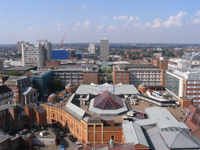
Dosya:Broadgate and Precincts - geograph.org.uk - 554599.jpg
Broadgate_and_Precincts_-_geograph.org.uk_-_554599.jpg ((640 × 480 piksel, dosya boyutu: 96 KB, MIME tipi: image/jpeg))
Dosya geçmişi
Dosyanın herhangi bir zamandaki hâli için ilgili tarih/saat kısmına tıklayın.
| Tarih/Saat | Küçük resim | Boyutlar | Kullanıcı | Yorum | |
|---|---|---|---|---|---|
| güncel | 02.26, 6 Şubat 2011 |  | 640 × 480 (96 KB) | GeographBot | == {{int:filedesc}} == {{Information |description={{en|1=Broadgate and Precincts Taken from the tower of the old cathedral church of St. Michael, looking westwards down the line of the Upper and Lower Precinct shopping areas towards Mercia House[1], the t |
Dosya kullanımı
Bu görüntü dosyasına bağlantısı olan sayfalar:
Küresel dosya kullanımı
Aşağıdaki diğer vikiler bu dosyayı kullanır:
- af.wikipedia.org üzerinde kullanımı
- an.wikipedia.org üzerinde kullanımı
- ar.wikipedia.org üzerinde kullanımı
- arz.wikipedia.org üzerinde kullanımı
- ast.wikipedia.org üzerinde kullanımı
- azb.wikipedia.org üzerinde kullanımı
- az.wikipedia.org üzerinde kullanımı
- be-tarask.wikipedia.org üzerinde kullanımı
- be.wikipedia.org üzerinde kullanımı
- ca.wikipedia.org üzerinde kullanımı
- ceb.wikipedia.org üzerinde kullanımı
- cs.wikipedia.org üzerinde kullanımı
- cy.wikipedia.org üzerinde kullanımı
- da.wikipedia.org üzerinde kullanımı
- de.wikipedia.org üzerinde kullanımı
- de.wikivoyage.org üzerinde kullanımı
- diq.wikipedia.org üzerinde kullanımı
- el.wikipedia.org üzerinde kullanımı
- en.wikipedia.org üzerinde kullanımı
- en.wikivoyage.org üzerinde kullanımı
- eo.wikipedia.org üzerinde kullanımı
- es.wikipedia.org üzerinde kullanımı
- eu.wikipedia.org üzerinde kullanımı
- frr.wikipedia.org üzerinde kullanımı
- fr.wikipedia.org üzerinde kullanımı
- fr.wikivoyage.org üzerinde kullanımı
- fy.wikipedia.org üzerinde kullanımı
- ga.wikipedia.org üzerinde kullanımı
- gl.wikipedia.org üzerinde kullanımı
- he.wikivoyage.org üzerinde kullanımı
- hy.wikipedia.org üzerinde kullanımı
- ku.wikipedia.org üzerinde kullanımı
- lld.wikipedia.org üzerinde kullanımı
- lv.wikipedia.org üzerinde kullanımı
- mdf.wikipedia.org üzerinde kullanımı
- mzn.wikipedia.org üzerinde kullanımı
- nn.wikipedia.org üzerinde kullanımı
- no.wikipedia.org üzerinde kullanımı
- os.wikipedia.org üzerinde kullanımı
- pl.wikipedia.org üzerinde kullanımı
- pl.wikivoyage.org üzerinde kullanımı
- pnb.wikipedia.org üzerinde kullanımı
- ro.wikipedia.org üzerinde kullanımı
- ru.wikinews.org üzerinde kullanımı
Bu dosyanın daha fazla küresel kullanımını görüntüle.


