
Dosya:SG-Settlements.png

Bu önizlemenin boyutu: 800 × 580 piksel. Diğer çözünürlükler: 320 × 232 piksel | 640 × 464 piksel | 1.024 × 742 piksel | 1.280 × 928 piksel | 2.560 × 1.856 piksel | 3.702 × 2.684 piksel.
Tam çözünürlük ((3.702 × 2.684 piksel, dosya boyutu: 419 KB, MIME tipi: image/png))
Bu dosya Wikimedia Commons'ta bulunmaktadır. Dosyanın açıklaması aşağıda gösterilmiştir. Commons, serbest/özgür telifli medya dosyalarının bulundurulduğu depodur. Siz de yardım edebilirsiniz. |
Özet
| Açıklama |
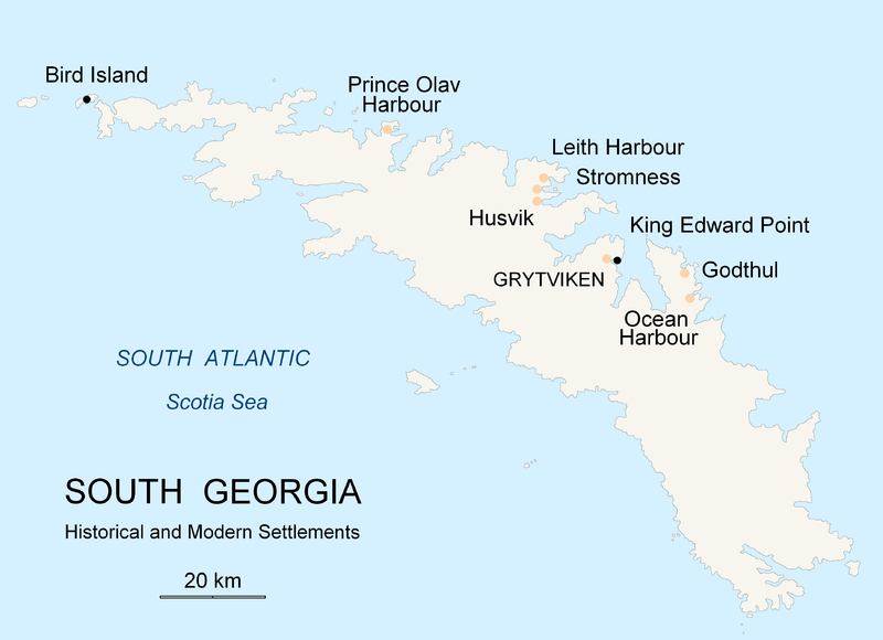
English: Map of South Georgia Island (Settlements) published by the author Apcbg. |
| Tarih | |
| Kaynak | Yükleyenin kendi çalışması |
| Yazar | Apcbg |
Lisanslama
Ben, bu işin telif sahibi, burada işi aşağıdaki lisans altında yayımlıyorum:

|
Bu belgenin GNU Özgür Belgeleme Lisansı, Sürüm 1.2 veya Özgür Yazılım Vakfı tarafından yayımlanan sonraki herhangi bir sürüm şartları altında bu belgenin kopyalanması, dağıtılması ve/veya değiştirilmesi için izin verilmiştir;
Değişmeyen Bölümler, Ön Kapak Metinleri ve Arka Kapak Metinleri yoktur. Lisansın bir kopyası GNU Özgür Belgeleme Lisansı sayfasında yer almaktadır. |
| Bu dosya, Creative Commons Atıf-Benzer Paylaşım 3.0 Taşınmamış lisansı ile lisanslanmıştır | ||
| ||
| Bu lisanslama etiketi, dosyaya GFDL lisanslama güncelleştirmenin bir parçası olarak eklenmiştir. |
Dosya geçmişi
Dosyanın herhangi bir zamandaki hâli için ilgili tarih/saat kısmına tıklayın.
| Tarih/Saat | Küçük resim | Boyutlar | Kullanıcı | Yorum | |
|---|---|---|---|---|---|
| güncel | 20.26, 18 Kasım 2007 | | 3.702 × 2.684 (419 KB) | Apcbg | {{Information |Description=Map of South Georgia Island (Settlements) published by the author Apcbg. |Source=self-made |Date=18 November 2007 |Author= Apcbg }} == Licensing == {{self|GFDL}} |
| 20.16, 18 Kasım 2007 |  | 3.702 × 2.684 (419 KB) | Apcbg | {{Information |Description=Map of South Georgia Island (Settlements) published by the author Apcbg. |Source=self-made |Date=18 November 2007 |Author= Apcbg }} == Licensing == {{self|GFDL}} | |
| 18.23, 18 Kasım 2007 |  | 3.702 × 2.684 (419 KB) | Apcbg | {{Information |Description=Map of South Georgia Island (Settlements) published by the author Apcbg. |Source=self-made |Date=18 November 2007 |Author= Apcbg }} == Licensing == {{self|GFDL}} | |
| 11.00, 7 Ekim 2007 |  | 2.962 × 1.952 (164 KB) | Apcbg | {{Information |Description=Map of South Georgia Island (Settlements) published by the author Apcbg. |Source=self-made |Date=7 October 2007 |Author= Apcbg }} == Licensing == {{self|GFDL}} | |
| 10.32, 7 Ekim 2007 |  | 2.962 × 1.952 (164 KB) | Apcbg | {{Information |Description=Map of South Georgia Island (Settlements) published by the author Apcbg. |Source=self-made |Date=7 October 2007 |Author= Apcbg }} == Licensing == {{self|GFDL}} | |
| 08.42, 7 Ekim 2007 |  | 2.962 × 1.952 (163 KB) | Apcbg | {{Information |Description=Map of South Georgia Island (Settlements) published by the author Apcbg. |Source=self-made |Date=7 October 2007 |Author= Apcbg }} == Licensing == {{self|GFDL}} | |
| 21.55, 5 Ekim 2007 |  | 2.962 × 1.952 (16,57 MB) | Apcbg | {{Information |Description=Map of South Georgia Island (Settlements) published by the author Apcbg. |Source=self-made |Date=5 October 2007 |Author= Apcbg }} == Licensing == {{self|GFDL}} | |
| 21.36, 5 Ekim 2007 |  | 2.962 × 1.952 (211 KB) | Apcbg | {{Information |Description=Map of South Georgia Island (Settlements) published by the author Apcbg. |Source=self-made |Date=5 October 2007 |Author= Apcbg }} == Licensing == {{self|GFDL}} |
Dosya kullanımı
Bu görüntü dosyasına bağlantısı olan sayfalar:
Küresel dosya kullanımı
Aşağıdaki diğer vikiler bu dosyayı kullanır:
- af.wikipedia.org üzerinde kullanımı
- ar.wikipedia.org üzerinde kullanımı
- bg.wikipedia.org üzerinde kullanımı
- bs.wikipedia.org üzerinde kullanımı
- ca.wikipedia.org üzerinde kullanımı
- de.wikipedia.org üzerinde kullanımı
- el.wikipedia.org üzerinde kullanımı
- en.wikipedia.org üzerinde kullanımı
- South Georgia and the South Sandwich Islands
- Grytviken
- South Georgia
- King Edward Point
- Bird Island, South Georgia
- History of South Georgia and the South Sandwich Islands
- Leith Harbour
- Solveig Gunbjørg Jacobsen
- Prince Olav Harbour
- Godthul
- Ocean Harbour
- Invasion of South Georgia
- Reindeer in South Georgia
- List of settlements in South Georgia and the South Sandwich Islands
- eo.wikipedia.org üzerinde kullanımı
- es.wikipedia.org üzerinde kullanımı
- et.wikipedia.org üzerinde kullanımı
- fa.wikipedia.org üzerinde kullanımı
- fi.wikipedia.org üzerinde kullanımı
- fr.wikipedia.org üzerinde kullanımı
- fy.wikipedia.org üzerinde kullanımı
- gd.wikipedia.org üzerinde kullanımı
- gl.wikipedia.org üzerinde kullanımı
- he.wikipedia.org üzerinde kullanımı
- hu.wikipedia.org üzerinde kullanımı
- id.wikipedia.org üzerinde kullanımı
- incubator.wikimedia.org üzerinde kullanımı
Bu dosyanın daha fazla küresel kullanımını görüntüle.